

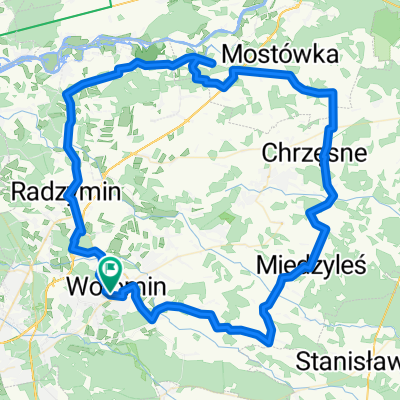
C_Ostrowik_AON_20km
A cycling route starting in Wołomin, Masovian Voivodeship, Poland.
Overview
About this route
- -:--
- Duration
- 19.7 km
- Distance
- 22 m
- Ascent
- 30 m
- Descent
- ---
- Avg. speed
- ---
- Max. altitude
Route quality
Waytypes & surfaces along the route
Waytypes
Road
13 km
(66 %)
Quiet road
5.7 km
(29 %)
Surfaces
Paved
15.5 km
(79 %)
Asphalt
15.5 km
(79 %)
Undefined
4.1 km
(21 %)
Continue with Bikemap
Use, edit, or download this cycling route
You would like to ride C_Ostrowik_AON_20km or customize it for your own trip? Here is what you can do with this Bikemap route:
Free features
- Save this route as favorite or in collections
- Copy & plan your own version of this route
- Sync your route with Garmin or Wahoo
Premium features
Free trial for 3 days, or one-time payment. More about Bikemap Premium.
- Navigate this route on iOS & Android
- Export a GPX / KML file of this route
- Create your custom printout (try it for free)
- Download this route for offline navigation
Discover more Premium features.
Get Bikemap PremiumFrom our community
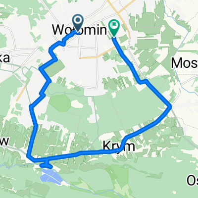
Other popular routes starting in Wołomin
 Polska_v3
- Distance
- 94.4 km
- Ascent
- 227 m
- Descent
- 227 m
- Location
- Wołomin, Masovian Voivodeship, Poland
 planowana trasa
- Distance
- 51.6 km
- Ascent
- 75 m
- Descent
- 73 m
- Location
- Wołomin, Masovian Voivodeship, Poland
 Wileńska 8, Wołomin do Leszczynowa 3, Kuligów
- Distance
- 31.2 km
- Ascent
- 164 m
- Descent
- 188 m
- Location
- Wołomin, Masovian Voivodeship, Poland
 Przechodnia do Lipińska
- Distance
- 15.8 km
- Ascent
- 124 m
- Descent
- 169 m
- Location
- Wołomin, Masovian Voivodeship, Poland
 52.341° N 21.249° W do 52.347° N 21.264° W
- Distance
- 19 km
- Ascent
- 16 m
- Descent
- 16 m
- Location
- Wołomin, Masovian Voivodeship, Poland
 C_Ostrowik_AON_20km
- Distance
- 19.7 km
- Ascent
- 22 m
- Descent
- 30 m
- Location
- Wołomin, Masovian Voivodeship, Poland
 Wołomin - Ropianka SINGLE TRACK
- Distance
- 402.4 km
- Ascent
- 834 m
- Descent
- 446 m
- Location
- Wołomin, Masovian Voivodeship, Poland
 Wołomin - Ostrołęka
- Distance
- 117 km
- Ascent
- 151 m
- Descent
- 154 m
- Location
- Wołomin, Masovian Voivodeship, Poland
Open it in the app