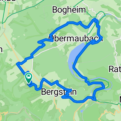
Rund um die Wehebachtalsperre CLONED FROM ROUTE 449308
- 21.4 km
- 337 m
- 337 m
- Hürtgenwald, North Rhine-Westphalia, Germany
Hard route with a lot of incline - 16%
From Mützenich to Roetgen through the Belgian forest, visible only in hybrid mode
Obermaubach, Heimbach, Gemünd, Einruhr invite you for a cup of coffee and cake. But not too much, afterward it's always steep uphill.
Vogelsang Castle is definitely worth a detour.
Track
19.9 km15 %Road
18.6 km14 %Paved
98.2 km(74 %)Unpaved
4 km(3 %)Asphalt
91.6 km69 %Paved (undefined)
6.6 km5 %Free trial for 3 days, or one-time payment. More about Bikemap Premium.
Discover more Premium features.
Get Bikemap PremiumOpen it in the app