la côt 5
- 19.5 km
- 727 m
- 727 m
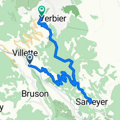
- Bagnes, Valais, Switzerland
A cycling route starting in Bagnes, Valais, Switzerland.
Overview
created this 6 years ago
Route quality
Road
10.1 km
(23 %)
Quiet road
5.3 km
(12 %)
Paved
20.6 km
(47 %)
Asphalt
20.6 km
(47 %)
Undefined
23.3 km
(53 %)
Continue with Bikemap
You would like to ride Le Chable Loop (After picnic) or customize it for your own trip? Here is what you can do with this Bikemap route:
Free trial for 3 days, or one-time payment. More about Bikemap Premium.
Discover more Premium features.
Get Bikemap PremiumFrom our community
Open it in the app