

06 E Sospel - Olliveta Pienne Haute plus eBramafan 35K
A cycling route starting in Sospel, Provence-Alpes-Côte d'Azur Region, France.
Overview
About this route
Attention, the descent from Levens passes through the Mercantour park.
- -:--
- Duration
- 34.7 km
- Distance
- 1,230 m
- Ascent
- 1,230 m
- Descent
- ---
- Avg. speed
- ---
- Max. altitude
Continue with Bikemap
Use, edit, or download this cycling route
You would like to ride 06 E Sospel - Olliveta Pienne Haute plus eBramafan 35K or customize it for your own trip? Here is what you can do with this Bikemap route:
Free features
- Save this route as favorite or in collections
- Copy & plan your own version of this route
- Sync your route with Garmin or Wahoo
Premium features
Free trial for 3 days, or one-time payment. More about Bikemap Premium.
- Navigate this route on iOS & Android
- Export a GPX / KML file of this route
- Create your custom printout (try it for free)
- Download this route for offline navigation
Discover more Premium features.
Get Bikemap PremiumFrom our community
Other popular routes starting in Sospel
 Tour 20: Col de Turini
- Distance
- 112.6 km
- Ascent
- 2,704 m
- Descent
- 2,697 m
- Location
- Sospel, Provence-Alpes-Côte d'Azur Region, France
 06 E Sospel - Olliveta Pienne Haute plus eBramafan 35K
- Distance
- 34.7 km
- Ascent
- 1,230 m
- Descent
- 1,230 m
- Location
- Sospel, Provence-Alpes-Côte d'Azur Region, France
 Southern French Alps 2004 stage 2
- Distance
- 39.3 km
- Ascent
- 1,382 m
- Descent
- 912 m
- Location
- Sospel, Provence-Alpes-Côte d'Azur Region, France
 Prowansja 9 - Sospel - Menton
- Distance
- 52.2 km
- Ascent
- 1,218 m
- Descent
- 1,222 m
- Location
- Sospel, Provence-Alpes-Côte d'Azur Region, France
 turini 2016
- Distance
- 95 km
- Ascent
- 2,487 m
- Descent
- 2,481 m
- Location
- Sospel, Provence-Alpes-Côte d'Azur Region, France
 Campsite Sospel - Moulinet - Sospel - Col du Braus
- Distance
- 48 km
- Ascent
- 1,149 m
- Descent
- 1,134 m
- Location
- Sospel, Provence-Alpes-Côte d'Azur Region, France
 Monaco - Sospel
- Distance
- 78.3 km
- Ascent
- 1,925 m
- Descent
- 1,925 m
- Location
- Sospel, Provence-Alpes-Côte d'Azur Region, France
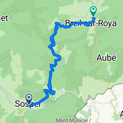 Von Sospel bis Breil-sur-Roya
- Distance
- 19.1 km
- Ascent
- 1,105 m
- Descent
- 1,155 m
- Location
- Sospel, Provence-Alpes-Côte d'Azur Region, France
Open it in the app