

Haus Sonntag (T44) Höchsten
A cycling route starting in Heiligenberg, Baden-Württemberg, Germany.
Overview
About this route
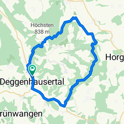
Streckentour Haus Sonntag - Höchsten und zurück
- -:--
- Duration
- 44 km
- Distance
- 573 m
- Ascent
- 573 m
- Descent
- ---
- Avg. speed
- ---
- Avg. speed

Route quality
Waytypes & surfaces along the route
Waytypes
Road
23.7 km
(54 %)
Busy road
11.9 km
(27 %)
Surfaces
Paved
43.6 km
(99 %)
Unpaved
0.1 km
(<1 %)
Asphalt
43.6 km
(99 %)
Gravel
0.1 km
(<1 %)
Undefined
0.3 km
(<1 %)
Continue with Bikemap
Use, edit, or download this cycling route
You would like to ride Haus Sonntag (T44) Höchsten or customize it for your own trip? Here is what you can do with this Bikemap route:
Free features
- Save this route as favorite or in collections
- Copy & plan your own version of this route
- Sync your route with Garmin or Wahoo
Premium features
Free trial for 3 days, or one-time payment. More about Bikemap Premium.
- Navigate this route on iOS & Android
- Export a GPX / KML file of this route
- Create your custom printout (try it for free)
- Download this route for offline navigation
Discover more Premium features.
Get Bikemap PremiumFrom our community
Other popular routes starting in Heiligenberg
 Salemertal - Meersburg - Uhldingen
- Distance
- 40.4 km
- Ascent
- 358 m
- Descent
- 370 m
- Location
- Heiligenberg, Baden-Württemberg, Germany
 Wilhelsdorf, Höchsten
- Distance
- 45.5 km
- Ascent
- 556 m
- Descent
- 556 m
- Location
- Heiligenberg, Baden-Württemberg, Germany
 Ideen erfahren 2012 - Tag 10
- Distance
- 47.7 km
- Ascent
- 651 m
- Descent
- 430 m
- Location
- Heiligenberg, Baden-Württemberg, Germany
 Fitnessrunde rund ums Haus Sonntag
- Distance
- 11.1 km
- Ascent
- 305 m
- Descent
- 304 m
- Location
- Heiligenberg, Baden-Württemberg, Germany
 Owingen, Taisersdorf
- Distance
- 35.5 km
- Ascent
- 444 m
- Descent
- 444 m
- Location
- Heiligenberg, Baden-Württemberg, Germany
 Leustetten-Engen-Birkendorf-Feldberg-Lörrach-Leustetten
- Distance
- 365.8 km
- Ascent
- 1,737 m
- Descent
- 1,737 m
- Location
- Heiligenberg, Baden-Württemberg, Germany
 D-Tal - Höchsten - (fast Hasenweiler) - Rotach - (fast) Urnau - D-Tal
- Distance
- 23.7 km
- Ascent
- 321 m
- Descent
- 321 m
- Location
- Heiligenberg, Baden-Württemberg, Germany
 Haus Sonntag (T100): Leustetten - Pfullingen
- Distance
- 100.7 km
- Ascent
- 665 m
- Descent
- 755 m
- Location
- Heiligenberg, Baden-Württemberg, Germany
Open it in the app