

HHH - Herford Hat Hügel
A cycling route starting in Herford, North Rhine-Westphalia, Germany.
Overview
About this route
Challenging sporty route - see elevation profile. But the efforts to 'climb' the hills will pose no problem for experienced cyclists. You'll be rewarded time and again with fantastic views over the Ravensberg region. I also find the view from Porta very impressive: between the two mountains, you can already see into the northern German lowlands. I really enjoyed the tour. I will definitely do it again; maybe then all the way to Bonneberg and further to Vlotho by the Weser. Reinhard , 09.07.2008
- -:--
- Duration
- 36.5 km
- Distance
- 526 m
- Ascent
- 558 m
- Descent
- ---
- Avg. speed
- 219 m
- Max. altitude
Route quality
Waytypes & surfaces along the route
Waytypes
Quiet road
26.6 km
(73 %)
Road
3.7 km
(10 %)
Surfaces
Paved
32.1 km
(88 %)
Asphalt
32.1 km
(88 %)
Undefined
4.4 km
(12 %)
Route highlights
Points of interest along the route
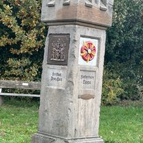
Point of interest after 24.5 km
Alternative: Hier lässt sich der Rückweg über weiter über die Amselstraße nach Herford rein etwas kürzer gestalten
Continue with Bikemap
Use, edit, or download this cycling route
You would like to ride HHH - Herford Hat Hügel or customize it for your own trip? Here is what you can do with this Bikemap route:
Free features
- Save this route as favorite or in collections
- Copy & plan your own version of this route
- Sync your route with Garmin or Wahoo
Premium features
Free trial for 3 days, or one-time payment. More about Bikemap Premium.
- Navigate this route on iOS & Android
- Export a GPX / KML file of this route
- Create your custom printout (try it for free)
- Download this route for offline navigation
Discover more Premium features.
Get Bikemap PremiumFrom our community
Other popular routes starting in Herford
 Rund um Enger - von Herford aus
- Distance
- 28.5 km
- Ascent
- 160 m
- Descent
- 184 m
- Location
- Herford, North Rhine-Westphalia, Germany
 Wittekindweg Etappe 1
- Distance
- 50.5 km
- Ascent
- 737 m
- Descent
- 785 m
- Location
- Herford, North Rhine-Westphalia, Germany
 Hansastraße, Herford nach Meißener Straße, Porta Westfalica
- Distance
- 33 km
- Ascent
- 262 m
- Descent
- 275 m
- Location
- Herford, North Rhine-Westphalia, Germany
 171014
- Distance
- 13.9 km
- Ascent
- 192 m
- Descent
- 184 m
- Location
- Herford, North Rhine-Westphalia, Germany
 Herford-Bielefeld
- Distance
- 24.1 km
- Ascent
- 98 m
- Descent
- 49 m
- Location
- Herford, North Rhine-Westphalia, Germany
 Riteln Herford-49km
- Distance
- 48.5 km
- Ascent
- 305 m
- Descent
- 302 m
- Location
- Herford, North Rhine-Westphalia, Germany
 Route Süd/Südwest
- Distance
- 21.9 km
- Ascent
- 98 m
- Descent
- 98 m
- Location
- Herford, North Rhine-Westphalia, Germany
 Jerrendorf 2
- Distance
- 9.6 km
- Ascent
- 92 m
- Descent
- 93 m
- Location
- Herford, North Rhine-Westphalia, Germany
Open it in the app