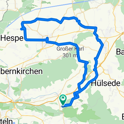
Rinteln-Weser-Schaumburg Tour
A cycling route starting in Rehren, Lower Saxony, Germany.
Overview
About this route
- -:--
- Duration
- 76.4 km
- Distance
- 541 m
- Ascent
- 541 m
- Descent
- ---
- Avg. speed
- ---
- Avg. speed
Route quality
Waytypes & surfaces along the route
Waytypes
Busy road
40 km
(52 %)
Road
12.7 km
(17 %)
Surfaces
Paved
66.8 km
(87 %)
Unpaved
0.8 km
(1 %)
Asphalt
63 km
(82 %)
Paved (undefined)
2.4 km
(3 %)
Route highlights
Points of interest along the route
Point of interest after 53 km
Continue with Bikemap
Use, edit, or download this cycling route
You would like to ride Rinteln-Weser-Schaumburg Tour or customize it for your own trip? Here is what you can do with this Bikemap route:
Free features
- Save this route as favorite or in collections
- Copy & plan your own version of this route
- Sync your route with Garmin or Wahoo
Premium features
Free trial for 3 days, or one-time payment. More about Bikemap Premium.
- Navigate this route on iOS & Android
- Export a GPX / KML file of this route
- Create your custom printout (try it for free)
- Download this route for offline navigation
Discover more Premium features.
Get Bikemap PremiumFrom our community
Other popular routes starting in Rehren
- Etappe 03 Rehren-Fischbeck
- Distance
- 15.9 km
- Ascent
- 162 m
- Descent
- 250 m
- Location
- Rehren, Lower Saxony, Germany
- BUECKEBERG ROUND 1
- Distance
- 16.8 km
- Ascent
- 268 m
- Descent
- 269 m
- Location
- Rehren, Lower Saxony, Germany
- Rannenberg - Hameln Fun Corner - Rannenberg
- Distance
- 41.5 km
- Ascent
- 141 m
- Descent
- 259 m
- Location
- Rehren, Lower Saxony, Germany
- Rinteln-Weser-Schaumburg Tour
- Distance
- 76.4 km
- Ascent
- 541 m
- Descent
- 541 m
- Location
- Rehren, Lower Saxony, Germany
- Rannenberg-Stadthagen-Meerbeck- Rodenberg-Rannenberg
- Distance
- 67.2 km
- Ascent
- 343 m
- Descent
- 398 m
- Location
- Rehren, Lower Saxony, Germany
- Rund ums Steinhuder Meer
- Distance
- 103.3 km
- Ascent
- 366 m
- Descent
- 365 m
- Location
- Rehren, Lower Saxony, Germany
- Drei-Burgen-Route
- Distance
- 13.2 km
- Ascent
- 484 m
- Descent
- 490 m
- Location
- Rehren, Lower Saxony, Germany
- Trail Bückeberg I
- Distance
- 10.8 km
- Ascent
- 192 m
- Descent
- 187 m
- Location
- Rehren, Lower Saxony, Germany
Open it in the app