

Hausrunden
Riedelbach - Burg Neuweilnau - Pferdskopfrunde
A cycling route starting in Schmitten, Hesse, Germany.
Overview
About this route
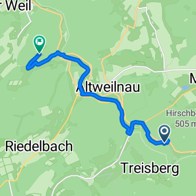
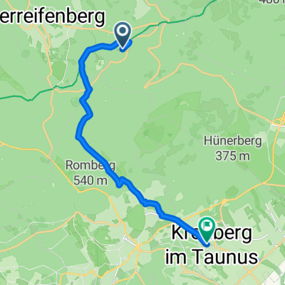
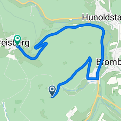
Along the Riedelbach towards Altweilnau with a view of Altweilnau Castle. Further uphill to the ruins of Neuweilnau Castle. Downward into the Weiltal and along the river of the same name to the ruins of Landstein Church. From there through the forest uphill to Treisdorf and to the lookout tower Pferdskopf. Going downhill through woods and fields to Finsternthal. There, a small detour to the llamas and alpacas, before completing the last elevation gain to the arboretum above Riedelbach.
- -:--
- Duration
- 15.2 km
- Distance
- 548 m
- Ascent
- 551 m
- Descent
- ---
- Avg. speed
- ---
- Max. altitude
Part of
Hausrunden
1 stage
Route photos


Continue with Bikemap
Use, edit, or download this cycling route
You would like to ride Riedelbach - Burg Neuweilnau - Pferdskopfrunde or customize it for your own trip? Here is what you can do with this Bikemap route:
Free features
- Save this route as favorite or in collections
- Copy & plan your own version of this route
- Sync your route with Garmin or Wahoo
Premium features
Free trial for 3 days, or one-time payment. More about Bikemap Premium.
- Navigate this route on iOS & Android
- Export a GPX / KML file of this route
- Create your custom printout (try it for free)
- Download this route for offline navigation
Discover more Premium features.
Get Bikemap PremiumFrom our community
Other popular routes starting in Schmitten
 Burg Weilstein, Weilrod nach Womberg
- Distance
- 7.6 km
- Ascent
- 184 m
- Descent
- 183 m
- Location
- Schmitten, Hesse, Germany
 Feldberg nach Niedereschbach
- Distance
- 18.8 km
- Ascent
- 15 m
- Descent
- 775 m
- Location
- Schmitten, Hesse, Germany
 Feldberg Zurück
- Distance
- 65 km
- Ascent
- 625 m
- Descent
- 935 m
- Location
- Schmitten, Hesse, Germany
 From Oberursel (Taunus) to Kronberg im Taunus
- Distance
- 11.5 km
- Ascent
- 106 m
- Descent
- 639 m
- Location
- Schmitten, Hesse, Germany
 schmitten treisberg
- Distance
- 5.5 km
- Ascent
- 196 m
- Descent
- 215 m
- Location
- Schmitten, Hesse, Germany
 Beidteweg 13, Schmitten nach Bassenheimer Straße 1, Schmitten
- Distance
- 7.2 km
- Ascent
- 352 m
- Descent
- 297 m
- Location
- Schmitten, Hesse, Germany
 Feldberg-Idstein
- Distance
- 20.1 km
- Ascent
- 109 m
- Descent
- 720 m
- Location
- Schmitten, Hesse, Germany
 USI-Naturfeundehaus-Hegewiese
- Distance
- 37.4 km
- Ascent
- 371 m
- Descent
- 589 m
- Location
- Schmitten, Hesse, Germany
Open it in the app