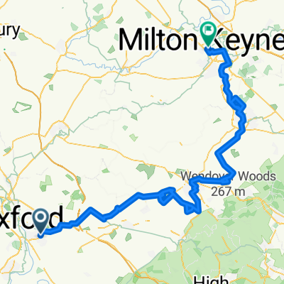
Bank Holiday Cougar Ride
A cycling route starting in Cowley, England, United Kingdom.
Overview
About this route
- -:--
- Duration
- 78.8 km
- Distance
- 228 m
- Ascent
- 226 m
- Descent
- ---
- Avg. speed
- ---
- Avg. speed
Route photos
Route quality
Waytypes & surfaces along the route
Waytypes
Road
49.1 km
(62 %)
Quiet road
15.2 km
(19 %)
Surfaces
Paved
45.6 km
(58 %)
Unpaved
0.1 km
(<1 %)
Asphalt
45.6 km
(58 %)
Ground
0.1 km
(<1 %)
Undefined
33.1 km
(42 %)
Continue with Bikemap
Use, edit, or download this cycling route
You would like to ride Bank Holiday Cougar Ride or customize it for your own trip? Here is what you can do with this Bikemap route:
Free features
- Save this route as favorite or in collections
- Copy & plan your own version of this route
- Sync your route with Garmin or Wahoo
Premium features
Free trial for 3 days, or one-time payment. More about Bikemap Premium.
- Navigate this route on iOS & Android
- Export a GPX / KML file of this route
- Create your custom printout (try it for free)
- Download this route for offline navigation
Discover more Premium features.
Get Bikemap PremiumFrom our community
Other popular routes starting in Cowley
- We love Brill
- Distance
- 45.5 km
- Ascent
- 216 m
- Descent
- 219 m
- Location
- Cowley, England, United Kingdom
- CAE Oxford Loop
- Distance
- 41.3 km
- Ascent
- 229 m
- Descent
- 196 m
- Location
- Cowley, England, United Kingdom
- Bank Holiday Cougar Ride
- Distance
- 78.8 km
- Ascent
- 228 m
- Descent
- 226 m
- Location
- Cowley, England, United Kingdom
- Charlbury Cycle
- Distance
- 117.8 km
- Ascent
- 415 m
- Descent
- 418 m
- Location
- Cowley, England, United Kingdom
- MeadowLane-Shotover-quiet route
- Distance
- 5.6 km
- Ascent
- 120 m
- Descent
- 5 m
- Location
- Cowley, England, United Kingdom
- Newbridge loop.
- Distance
- 48.2 km
- Ascent
- 138 m
- Descent
- 137 m
- Location
- Cowley, England, United Kingdom
- Watlington lasso
- Distance
- 45.3 km
- Ascent
- 186 m
- Descent
- 186 m
- Location
- Cowley, England, United Kingdom
- Horspath 20 miler (Oxfordshire)
- Distance
- 31.6 km
- Ascent
- 182 m
- Descent
- 179 m
- Location
- Cowley, England, United Kingdom
Open it in the app