poppyshort2022
- 75.9 km
- 0 m
- 0 m
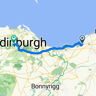
- Prestonpans, Scotland, United Kingdom
A cycling route starting in Prestonpans, Scotland, United Kingdom.
Overview
off road route to the start of the Waggonway behind the Brig Inn, Tranent
almost entirely separated from roads. The trail starts at the southern side of the railway station (use the bridge) and heads past Bankton House towards the Battlefield viewpoint and through the car park of the sports centre up the hill into Tranent. Pick up your Waggonway leaflet from the Brig Inn.
created this 6 years ago
Continue with Bikemap
You would like to ride Prestonpans train station to Brig Inn, Tranent, for the Waggonway or customize it for your own trip? Here is what you can do with this Bikemap route:
Free trial for 3 days, or one-time payment. More about Bikemap Premium.
Discover more Premium features.
Get Bikemap PremiumFrom our community
Open it in the app