

Rio Maior - Barrancos - Rio Maior/DIA10
A cycling route starting in Marinhais, Santarém District, Portugal.
Overview
About this route
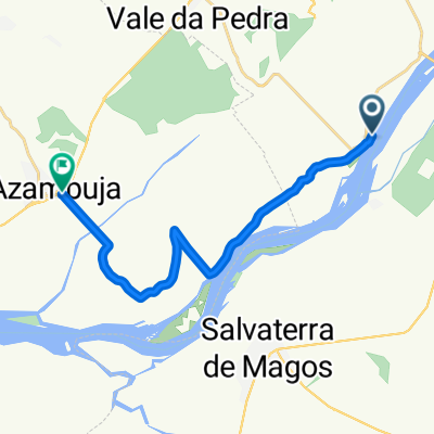
Escaroupim - Asseiceira
- -:--
- Duration
- 45.9 km
- Distance
- 291 m
- Ascent
- 250 m
- Descent
- ---
- Avg. speed
- ---
- Max. altitude

Route photos


Route quality
Waytypes & surfaces along the route
Waytypes
Road
22 km
(48 %)
Track
5.5 km
(12 %)
Surfaces
Paved
24.3 km
(53 %)
Unpaved
7.3 km
(16 %)
Asphalt
24.3 km
(53 %)
Unpaved (undefined)
7.3 km
(16 %)
Undefined
14.2 km
(31 %)
Continue with Bikemap
Use, edit, or download this cycling route
You would like to ride Rio Maior - Barrancos - Rio Maior/DIA10 or customize it for your own trip? Here is what you can do with this Bikemap route:
Free features
- Save this route as favorite or in collections
- Copy & plan your own version of this route
- Sync your route with Garmin or Wahoo
Premium features
Free trial for 3 days, or one-time payment. More about Bikemap Premium.
- Navigate this route on iOS & Android
- Export a GPX / KML file of this route
- Create your custom printout (try it for free)
- Download this route for offline navigation
Discover more Premium features.
Get Bikemap PremiumFrom our community
Other popular routes starting in Marinhais
 Rio Maior - Barrancos - Rio Maior/DIA10
- Distance
- 45.9 km
- Ascent
- 291 m
- Descent
- 250 m
- Location
- Marinhais, Santarém District, Portugal
 Portugal - Etapa2 Escaroupim-Fatima
- Distance
- 83.2 km
- Ascent
- 870 m
- Descent
- 542 m
- Location
- Marinhais, Santarém District, Portugal
 Portugalsko-sobota
- Distance
- 56.2 km
- Ascent
- 585 m
- Descent
- 509 m
- Location
- Marinhais, Santarém District, Portugal
 TransAlqueva
- Distance
- 295.1 km
- Ascent
- 320 m
- Descent
- 234 m
- Location
- Marinhais, Santarém District, Portugal
 LongRide dos canais do Sorraia #SARTIM #Rolar com a turma do Maumau
- Distance
- 69.3 km
- Ascent
- 352 m
- Descent
- 353 m
- Location
- Marinhais, Santarém District, Portugal
 VALADA_AZAMB
- Distance
- 15.7 km
- Ascent
- 18 m
- Descent
- 17 m
- Location
- Marinhais, Santarém District, Portugal
 Gloria-Magos-Fajarda-Serrao
- Distance
- 70.5 km
- Ascent
- 317 m
- Descent
- 316 m
- Location
- Marinhais, Santarém District, Portugal
 Str-Benavente-Muge-Cartaxo-Str
- Distance
- 100.2 km
- Ascent
- 404 m
- Descent
- 324 m
- Location
- Marinhais, Santarém District, Portugal
Open it in the app