

Ochladenie na jazere Úhorná
A cycling route starting in Rožňava, Košice Region, Slovakia.
Overview
About this route
It is possible to swim in the lake. There is a snack bar nearby.
- -:--
- Duration
- 42.1 km
- Distance
- 1,034 m
- Ascent
- 1,034 m
- Descent
- ---
- Avg. speed
- ---
- Max. altitude

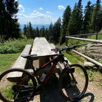
Route photos

Route quality
Waytypes & surfaces along the route
Waytypes
Track
24.4 km
(58 %)
Road
6.7 km
(16 %)
Undefined
11 km
(26 %)
Surfaces
Paved
32.5 km
(77 %)
Unpaved
3.4 km
(8 %)
Asphalt
29.5 km
(70 %)
Paved (undefined)
3 km
(7 %)
Route highlights
Points of interest along the route

Photo after 20.9 km
Jazero Úhorná
Continue with Bikemap
Use, edit, or download this cycling route
You would like to ride Ochladenie na jazere Úhorná or customize it for your own trip? Here is what you can do with this Bikemap route:
Free features
- Save this route as favorite or in collections
- Copy & plan your own version of this route
- Sync your route with Garmin or Wahoo
Premium features
Free trial for 3 days, or one-time payment. More about Bikemap Premium.
- Navigate this route on iOS & Android
- Export a GPX / KML file of this route
- Create your custom printout (try it for free)
- Download this route for offline navigation
Discover more Premium features.
Get Bikemap PremiumFrom our community
Other popular routes starting in Rožňava
 Soroska - Silica - Silicka ladnica
- Distance
- 32.2 km
- Ascent
- 403 m
- Descent
- 403 m
- Location
- Rožňava, Košice Region, Slovakia
 chata Volovec
- Distance
- 13.8 km
- Ascent
- 1,126 m
- Descent
- 365 m
- Location
- Rožňava, Košice Region, Slovakia
 Soroska - Dievcenska skala
- Distance
- 17.3 km
- Ascent
- 632 m
- Descent
- 637 m
- Location
- Rožňava, Košice Region, Slovakia
 Za Čučmou
- Distance
- 13.2 km
- Ascent
- 602 m
- Descent
- 607 m
- Location
- Rožňava, Košice Region, Slovakia
 Stit
Stit- Distance
- 39.3 km
- Ascent
- 680 m
- Descent
- 683 m
- Location
- Rožňava, Košice Region, Slovakia
 Test
Test- Distance
- 24.7 km
- Ascent
- 446 m
- Descent
- 446 m
- Location
- Rožňava, Košice Region, Slovakia
 Krásna Hôrka Smolník cez Hekerovú
- Distance
- 21.3 km
- Ascent
- 902 m
- Descent
- 711 m
- Location
- Rožňava, Košice Region, Slovakia
 Úhornianske sedlo- Kaplnka- Jezero
- Distance
- 8 km
- Ascent
- 142 m
- Descent
- 502 m
- Location
- Rožňava, Košice Region, Slovakia
Open it in the app