

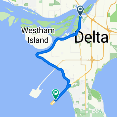
Lily Point
A cycling route starting in Ladner, British Columbia, Canada.
Overview
About this route
Tsawwaseen to Point Roberts, loop and back. Look for the 1st Nations petroglyph on the boulder at the Lily Point beach
- -:--
- Duration
- 25.2 km
- Distance
- 158 m
- Ascent
- 156 m
- Descent
- ---
- Avg. speed
- ---
- Avg. speed

Route quality
Waytypes & surfaces along the route
Waytypes
Road
8.9 km
(35 %)
Busy road
6.5 km
(26 %)
Surfaces
Paved
2.2 km
(9 %)
Unpaved
2 km
(8 %)
Asphalt
2 km
(8 %)
Gravel
2 km
(8 %)
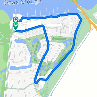
Route highlights
Points of interest along the route

Point of interest after 10.2 km
Petroglyph carved into beach boulder
Point of interest after 14.3 km
Breakwaters Restaurant
Point of interest after 16.9 km
Lighthouse Park
Point of interest after 18.9 km
Saltwater Cafe

Point of interest after 19.1 km
The Reef Bar/Restaurant
Continue with Bikemap
Use, edit, or download this cycling route
You would like to ride Lily Point or customize it for your own trip? Here is what you can do with this Bikemap route:
Free features
- Save this route as favorite or in collections
- Copy & plan your own version of this route
- Sync your route with Garmin or Wahoo
Premium features
Free trial for 3 days, or one-time payment. More about Bikemap Premium.
- Navigate this route on iOS & Android
- Export a GPX / KML file of this route
- Create your custom printout (try it for free)
- Download this route for offline navigation
Discover more Premium features.
Get Bikemap PremiumFrom our community
Other popular routes starting in Ladner
 13292–13544 Gilbert Rd, Richmond to 8100–8286 Dyke Rd, Richmond
- Distance
- 20.6 km
- Ascent
- 50 m
- Descent
- 48 m
- Location
- Ladner, British Columbia, Canada
 Ferry Terminal
- Distance
- 6.6 km
- Ascent
- 22 m
- Descent
- 35 m
- Location
- Ladner, British Columbia, Canada
 Delta to Ferry
- Distance
- 19.4 km
- Ascent
- 4 m
- Descent
- 8 m
- Location
- Ladner, British Columbia, Canada
 Admiral Way, Delta to Admiral Way, Delta
- Distance
- 3.1 km
- Ascent
- 15 m
- Descent
- 9 m
- Location
- Ladner, British Columbia, Canada
 Tsawwassen - Tunnel shuttle
- Distance
- 16.3 km
- Ascent
- 4 m
- Descent
- 0 m
- Location
- Ladner, British Columbia, Canada
 Tsawwassen to Deas Island
- Distance
- 34.8 km
- Ascent
- 32 m
- Descent
- 37 m
- Location
- Ladner, British Columbia, Canada
 Ocean to Ocean Canada
- Distance
- 7,579 km
- Ascent
- 0 m
- Descent
- 0 m
- Location
- Ladner, British Columbia, Canada
 Recovered Route
- Distance
- 47.6 km
- Ascent
- 12 m
- Descent
- 13 m
- Location
- Ladner, British Columbia, Canada
Open it in the app