

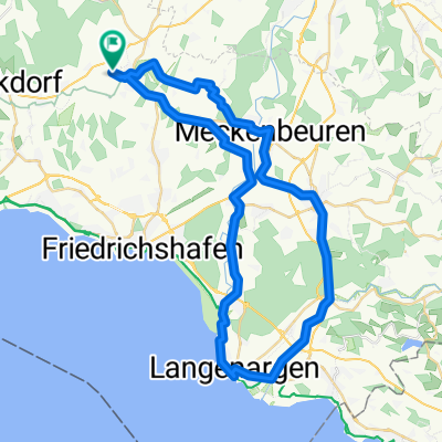
Gehrenberg-Heiligenberg-Höchsten-Benistobel-Urbanstobel
A cycling route starting in Oberteuringen, Baden-Wurttemberg, Germany.
Overview
About this route
- -:--
- Duration
- 50.3 km
- Distance
- 984 m
- Ascent
- 983 m
- Descent
- ---
- Avg. speed
- ---
- Max. altitude
Route quality
Waytypes & surfaces along the route
Waytypes
Track
23.6 km
(47 %)
Quiet road
15.1 km
(30 %)
Surfaces
Paved
24.7 km
(49 %)
Unpaved
21.6 km
(43 %)
Asphalt
24.2 km
(48 %)
Gravel
11.1 km
(22 %)
Continue with Bikemap
Use, edit, or download this cycling route
You would like to ride Gehrenberg-Heiligenberg-Höchsten-Benistobel-Urbanstobel or customize it for your own trip? Here is what you can do with this Bikemap route:
Free features
- Save this route as favorite or in collections
- Copy & plan your own version of this route
- Sync your route with Garmin or Wahoo
Premium features
Free trial for 3 days, or one-time payment. More about Bikemap Premium.
- Navigate this route on iOS & Android
- Export a GPX / KML file of this route
- Create your custom printout (try it for free)
- Download this route for offline navigation
Discover more Premium features.
Get Bikemap PremiumFrom our community
Other popular routes starting in Oberteuringen
 TOUR-Magazin "Allgäu"
- Distance
- 77.5 km
- Ascent
- 896 m
- Descent
- 904 m
- Location
- Oberteuringen, Baden-Wurttemberg, Germany
 OT Langenargen
- Distance
- 49.1 km
- Ascent
- 175 m
- Descent
- 178 m
- Location
- Oberteuringen, Baden-Wurttemberg, Germany
 Gehrenberg-Heiligenberg-Höchsten-Benistobel-Urbanstobel
- Distance
- 50.3 km
- Ascent
- 984 m
- Descent
- 983 m
- Location
- Oberteuringen, Baden-Wurttemberg, Germany
 Runde in Oberschwaben
- Distance
- 110.1 km
- Ascent
- 756 m
- Descent
- 623 m
- Location
- Oberteuringen, Baden-Wurttemberg, Germany
 Zum Hackl Schorsch
- Distance
- 21.3 km
- Ascent
- 453 m
- Descent
- 208 m
- Location
- Oberteuringen, Baden-Wurttemberg, Germany
 Linzgautour
- Distance
- 69.9 km
- Ascent
- 487 m
- Descent
- 501 m
- Location
- Oberteuringen, Baden-Wurttemberg, Germany
 Hopfenrunde Taldorf
- Distance
- 59.9 km
- Ascent
- 354 m
- Descent
- 358 m
- Location
- Oberteuringen, Baden-Wurttemberg, Germany
 Altshausen
- Distance
- 81.1 km
- Ascent
- 524 m
- Descent
- 527 m
- Location
- Oberteuringen, Baden-Wurttemberg, Germany
Open it in the app