

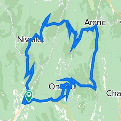
Bugey
A cycling route starting in Saint-Rambert-en-Bugey, Auvergne-Rhône-Alpes, France.
Overview
About this route
- -:--
- Duration
- 58.3 km
- Distance
- 1,313 m
- Ascent
- 1,313 m
- Descent
- ---
- Avg. speed
- ---
- Max. altitude
Route quality
Waytypes & surfaces along the route
Waytypes
Road
46.6 km
(80 %)
Busy road
7 km
(12 %)
Surfaces
Paved
6.5 km
(11 %)
Unpaved
2.8 km
(5 %)
Asphalt
6.5 km
(11 %)
Gravel
1.5 km
(3 %)
Continue with Bikemap
Use, edit, or download this cycling route
You would like to ride Bugey or customize it for your own trip? Here is what you can do with this Bikemap route:
Free features
- Save this route as favorite or in collections
- Copy & plan your own version of this route
- Sync your route with Garmin or Wahoo
Premium features
Free trial for 3 days, or one-time payment. More about Bikemap Premium.
- Navigate this route on iOS & Android
- Export a GPX / KML file of this route
- Create your custom printout (try it for free)
- Download this route for offline navigation
Discover more Premium features.
Get Bikemap PremiumFrom our community
Other popular routes starting in Saint-Rambert-en-Bugey
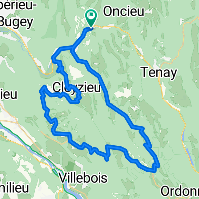
 Tour de l'Ain-Day-03
- Distance
- 79.8 km
- Ascent
- 528 m
- Descent
- 588 m
- Location
- Saint-Rambert-en-Bugey, Auvergne-Rhône-Alpes, France
 tour bugey
- Distance
- 35.9 km
- Ascent
- 813 m
- Descent
- 813 m
- Location
- Saint-Rambert-en-Bugey, Auvergne-Rhône-Alpes, France
 Balade en Bugey
- Distance
- 53.4 km
- Ascent
- 1,110 m
- Descent
- 1,113 m
- Location
- Saint-Rambert-en-Bugey, Auvergne-Rhône-Alpes, France
 Bugey
Bugey- Distance
- 58.3 km
- Ascent
- 1,313 m
- Descent
- 1,313 m
- Location
- Saint-Rambert-en-Bugey, Auvergne-Rhône-Alpes, France
 St Rambert-Col de Fay-Col de Portes-St Rambert
- Distance
- 47.4 km
- Ascent
- 1,005 m
- Descent
- 1,006 m
- Location
- Saint-Rambert-en-Bugey, Auvergne-Rhône-Alpes, France
 Saint-Rambert - Indrieux - Plomb - Tenay
- Distance
- 20.6 km
- Ascent
- 742 m
- Descent
- 685 m
- Location
- Saint-Rambert-en-Bugey, Auvergne-Rhône-Alpes, France
 Col de Portes depuis St Rambert en Bugey
- Distance
- 37.1 km
- Ascent
- 782 m
- Descent
- 783 m
- Location
- Saint-Rambert-en-Bugey, Auvergne-Rhône-Alpes, France
 Itinéraire modéré en Caluire-et-Cuire
- Distance
- 80.6 km
- Ascent
- 498 m
- Descent
- 584 m
- Location
- Saint-Rambert-en-Bugey, Auvergne-Rhône-Alpes, France
Open it in the app