

with Emma
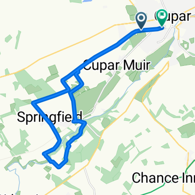
A cycling route starting in Cupar, Scotland, United Kingdom.
Overview
About this route
- 1 h 9 min
- Duration
- 12.3 km
- Distance
- 159 m
- Ascent
- 164 m
- Descent
- 10.7 km/h
- Avg. speed
- ---
- Max. altitude

Continue with Bikemap
Use, edit, or download this cycling route
You would like to ride with Emma or customize it for your own trip? Here is what you can do with this Bikemap route:
Free features
- Save this route as favorite or in collections
- Copy & plan your own version of this route
- Sync your route with Garmin or Wahoo
Premium features
Free trial for 3 days, or one-time payment. More about Bikemap Premium.
- Navigate this route on iOS & Android
- Export a GPX / KML file of this route
- Create your custom printout (try it for free)
- Download this route for offline navigation
Discover more Premium features.
Get Bikemap PremiumFrom our community
Other popular routes starting in Cupar
 Cupar to St Andrews and back
- Distance
- 35.6 km
- Ascent
- 358 m
- Descent
- 357 m
- Location
- Cupar, Scotland, United Kingdom
 Cupar Loop - east, take 2
- Distance
- 71.8 km
- Ascent
- 835 m
- Descent
- 832 m
- Location
- Cupar, Scotland, United Kingdom
 Cupar Tay circuit
- Distance
- 57.5 km
- Ascent
- 549 m
- Descent
- 548 m
- Location
- Cupar, Scotland, United Kingdom
 cupar st andrews
- Distance
- 52.2 km
- Ascent
- 394 m
- Descent
- 390 m
- Location
- Cupar, Scotland, United Kingdom
 Cupar to Glenrothes and back
- Distance
- 48.1 km
- Ascent
- 270 m
- Descent
- 267 m
- Location
- Cupar, Scotland, United Kingdom
 2–8 Bonnygate, Cupar to St Andrews Road, Ceres, Cupar
- Distance
- 5 km
- Ascent
- 87 m
- Descent
- 38 m
- Location
- Cupar, Scotland, United Kingdom
 Cupar to Glenrothes and back
- Distance
- 48.4 km
- Ascent
- 260 m
- Descent
- 256 m
- Location
- Cupar, Scotland, United Kingdom
 with Emma
- Distance
- 12.3 km
- Ascent
- 159 m
- Descent
- 164 m
- Location
- Cupar, Scotland, United Kingdom
Open it in the app