

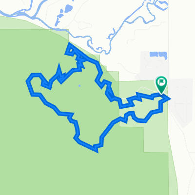
Gunnison - Sargents - Monarch Pass & Back
A cycling route starting in Gunnison, Colorado, United States.
Overview
About this route
- -:--
- Duration
- 136.4 km
- Distance
- 1,086 m
- Ascent
- 1,086 m
- Descent
- ---
- Avg. speed
- ---
- Max. altitude

Route quality
Waytypes & surfaces along the route
Waytypes
Cycleway
75 km
(55 %)
Quiet road
27.5 km
(20 %)
Surfaces
Paved
83.7 km
(61 %)
Unpaved
44.5 km
(33 %)
Asphalt
82.5 km
(61 %)
Unpaved (undefined)
26.1 km
(19 %)
Continue with Bikemap
Use, edit, or download this cycling route
You would like to ride Gunnison - Sargents - Monarch Pass & Back or customize it for your own trip? Here is what you can do with this Bikemap route:
Free features
- Save this route as favorite or in collections
- Copy & plan your own version of this route
- Split it into stages to create a multi-day tour
- Sync your route with Garmin or Wahoo
Premium features
Free trial for 3 days, or one-time payment. More about Bikemap Premium.
- Navigate this route on iOS & Android
- Export a GPX / KML file of this route
- Create your custom printout (try it for free)
- Download this route for offline navigation
Discover more Premium features.
Get Bikemap PremiumFrom our community
Other popular routes starting in Gunnison
 Gunnison mixed gravel-pavement loop
- Distance
- 183 km
- Ascent
- 1,159 m
- Descent
- 1,160 m
- Location
- Gunnison, Colorado, United States
 Stage 3: Gunnison to Monarch Mountain
- Distance
- 159.8 km
- Ascent
- 2,307 m
- Descent
- 1,351 m
- Location
- Gunnison, Colorado, United States
 Gunnison - Alamosa_3rd
- Distance
- 204.3 km
- Ascent
- 1,266 m
- Descent
- 1,319 m
- Location
- Gunnison, Colorado, United States
 Gunnison - Sargents - Monarch Pass & Back
- Distance
- 136.4 km
- Ascent
- 1,086 m
- Descent
- 1,086 m
- Location
- Gunnison, Colorado, United States
 2018-06-21. Gunison - Salida
- Distance
- 108.2 km
- Ascent
- 1,104 m
- Descent
- 1,273 m
- Location
- Gunnison, Colorado, United States
 Gunnison - Buena Vista - Frisco
- Distance
- 360.4 km
- Ascent
- 3,328 m
- Descent
- 4,095 m
- Location
- Gunnison, Colorado, United States
 testing testing 1,2,3
- Distance
- 9.8 km
- Ascent
- 259 m
- Descent
- 259 m
- Location
- Gunnison, Colorado, United States
 33 mile Ohio Creek Loop
- Distance
- 52.7 km
- Ascent
- 568 m
- Descent
- 565 m
- Location
- Gunnison, Colorado, United States
Open it in the app