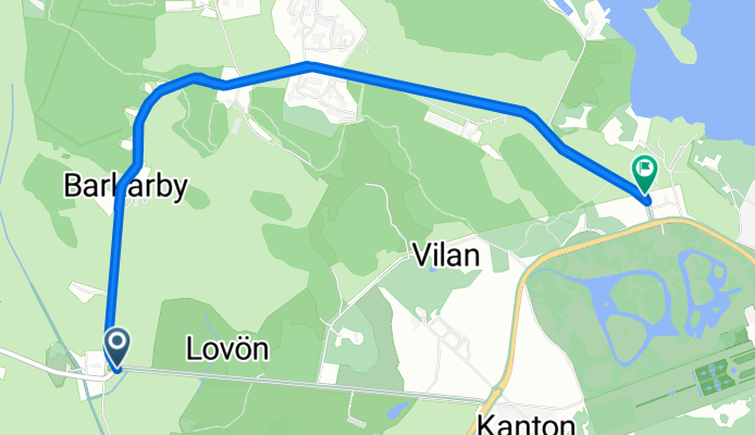
Ekerö Cycling
A cycling route starting in Ekerö, Stockholm County, Sweden.
Overview
About this route
2713®
- -:--
- Duration
- 13.5 km
- Distance
- 81 m
- Ascent
- 84 m
- Descent
- ---
- Avg. speed
- ---
- Max. altitude
Route quality
Waytypes & surfaces along the route
Waytypes
Road
13.5 km
(100 %)
Surfaces
Paved
13.5 km
(100 %)
Asphalt
13.5 km
(100 %)
Continue with Bikemap
Use, edit, or download this cycling route
You would like to ride Ekerö Cycling or customize it for your own trip? Here is what you can do with this Bikemap route:
Free features
- Save this route as favorite or in collections
- Copy & plan your own version of this route
- Sync your route with Garmin or Wahoo
Premium features
Free trial for 3 days, or one-time payment. More about Bikemap Premium.
- Navigate this route on iOS & Android
- Export a GPX / KML file of this route
- Create your custom printout (try it for free)
- Download this route for offline navigation
Discover more Premium features.
Get Bikemap PremiumFrom our community
Other popular routes starting in Ekerö

Edge 820®
Ekerö Cycling- Distance
- 59.8 km
- Ascent
- 296 m
- Descent
- 260 m
- Location
- Ekerö, Stockholm County, Sweden
färingsö- Distance
- 48.8 km
- Ascent
- 404 m
- Descent
- 404 m
- Location
- Ekerö, Stockholm County, Sweden
Mälaren runt- Distance
- 342.6 km
- Ascent
- 391 m
- Descent
- 393 m
- Location
- Ekerö, Stockholm County, Sweden

Tappströmsvägen 2 to Drottningholmsvägen 211- Distance
- 12.7 km
- Ascent
- 84 m
- Descent
- 77 m
- Location
- Ekerö, Stockholm County, Sweden
tappström-kungsholmen- Distance
- 16 km
- Ascent
- 152 m
- Descent
- 133 m
- Location
- Ekerö, Stockholm County, Sweden
Bryggavägen 94A, Ekerö to Bryggavägen 94A, Ekerö- Distance
- 9.1 km
- Ascent
- 153 m
- Descent
- 154 m
- Location
- Ekerö, Stockholm County, Sweden
Restful route in Ekerö- Distance
- 8.1 km
- Ascent
- 0 m
- Descent
- 4 m
- Location
- Ekerö, Stockholm County, Sweden
Open it in the app


