

Wangaratta circuit (VIC-AU)
A cycling route starting in Wangaratta, Victoria, Australia.
Overview
About this route
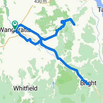
Start at Apex Park and follow Ovens River route (there will be sculptures to view on this route). After Ovens River route there are various bike track options (paved and unpaved). Many will be besides parks, off-road next to town roads, along creeks. Overall a pleasant town to cycyle in. Return to Apex Park (car parking is there also if you come by car).
Many other routes can be followed in Wangaratta.
- -:--
- Duration
- 11.3 km
- Distance
- 63 m
- Ascent
- 59 m
- Descent
- ---
- Avg. speed
- 153 m
- Max. altitude

Route photos
\"")
\"")
\"")
\"")
\"")
\"")
\"")
Continue with Bikemap
Use, edit, or download this cycling route
You would like to ride Wangaratta circuit (VIC-AU) or customize it for your own trip? Here is what you can do with this Bikemap route:
Free features
- Save this route as favorite or in collections
- Copy & plan your own version of this route
- Sync your route with Garmin or Wahoo
Premium features
Free trial for 3 days, or one-time payment. More about Bikemap Premium.
- Navigate this route on iOS & Android
- Export a GPX / KML file of this route
- Create your custom printout (try it for free)
- Download this route for offline navigation
Discover more Premium features.
Get Bikemap PremiumFrom our community
Other popular routes starting in Wangaratta
 Buckland Valley - West Kiewa loop
- Distance
- 332.1 km
- Ascent
- 2,378 m
- Descent
- 2,384 m
- Location
- Wangaratta, Victoria, Australia
 Untitled route
- Distance
- 257.3 km
- Ascent
- 1,873 m
- Descent
- 1,875 m
- Location
- Wangaratta, Victoria, Australia
 Eva Street 1, Wangaratta to Eva Street 1, Wangaratta
- Distance
- 12.8 km
- Ascent
- 14 m
- Descent
- 15 m
- Location
- Wangaratta, Victoria, Australia
 Wangaratta Loop
- Distance
- 52.9 km
- Ascent
- 379 m
- Descent
- 382 m
- Location
- Wangaratta, Victoria, Australia
 Wangaratta, Greta, Glenrowan, Wangaratta
- Distance
- 50.9 km
- Ascent
- 98 m
- Descent
- 94 m
- Location
- Wangaratta, Victoria, Australia
 Wangaratta to Albury
- Distance
- 112.9 km
- Ascent
- 1,057 m
- Descent
- 1,050 m
- Location
- Wangaratta, Victoria, Australia
 Wangaratta to Lilydale Bush Tour
- Distance
- 494.7 km
- Ascent
- 4,949 m
- Descent
- 4,997 m
- Location
- Wangaratta, Victoria, Australia
 Herald Sun Tour 2017 Stage 1
- Distance
- 178.9 km
- Ascent
- 2,096 m
- Descent
- 699 m
- Location
- Wangaratta, Victoria, Australia
Open it in the app