

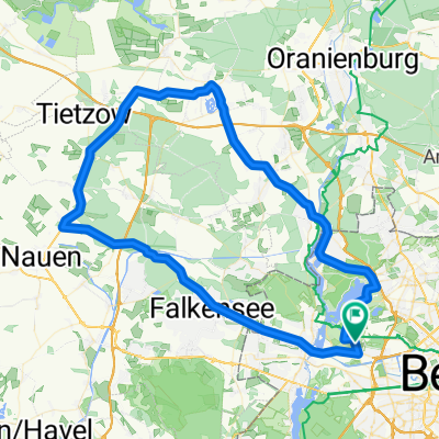
20190518-MTB
A cycling route starting in Siemensstadt, Land Berlin, Germany.
Overview
About this route
- -:--
- Duration
- 39.2 km
- Distance
- 96 m
- Ascent
- 94 m
- Descent
- ---
- Avg. speed
- ---
- Max. altitude

Continue with Bikemap
Use, edit, or download this cycling route
You would like to ride 20190518-MTB or customize it for your own trip? Here is what you can do with this Bikemap route:
Free features
- Save this route as favorite or in collections
- Copy & plan your own version of this route
- Sync your route with Garmin or Wahoo
Premium features
Free trial for 3 days, or one-time payment. More about Bikemap Premium.
- Navigate this route on iOS & Android
- Export a GPX / KML file of this route
- Create your custom printout (try it for free)
- Download this route for offline navigation
Discover more Premium features.
Get Bikemap PremiumFrom our community
Other popular routes starting in Siemensstadt
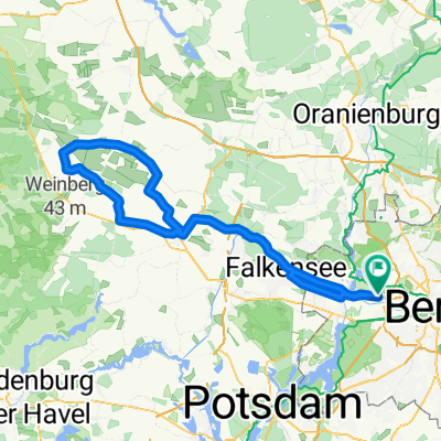
 Auerbach->Beelitz
- Distance
- 124.1 km
- Ascent
- 448 m
- Descent
- 433 m
- Location
- Siemensstadt, Land Berlin, Germany
 20190518-MTB
- Distance
- 39.2 km
- Ascent
- 96 m
- Descent
- 94 m
- Location
- Siemensstadt, Land Berlin, Germany
 Beelitz Feierabendrunde am 7.8.08
- Distance
- 128.1 km
- Ascent
- 440 m
- Descent
- 426 m
- Location
- Siemensstadt, Land Berlin, Germany
 Grunewald-Wannsee-Spandau
- Distance
- 31.5 km
- Ascent
- 129 m
- Descent
- 134 m
- Location
- Siemensstadt, Land Berlin, Germany
 Spandau-Tegel-Groß Ziethen-Börnicke-Falkensee-Spandau
- Distance
- 81 km
- Ascent
- 148 m
- Descent
- 144 m
- Location
- Siemensstadt, Land Berlin, Germany
 Sonntagsrunde mit den »Havellandriders« 31.08.08
- Distance
- 112.5 km
- Ascent
- 115 m
- Descent
- 116 m
- Location
- Siemensstadt, Land Berlin, Germany
 Havel+TeglerSee
- Distance
- 40.5 km
- Ascent
- 62 m
- Descent
- 63 m
- Location
- Siemensstadt, Land Berlin, Germany
 Auerbach->R1->Golzow 09.08.2008
- Distance
- 177.8 km
- Ascent
- 492 m
- Descent
- 482 m
- Location
- Siemensstadt, Land Berlin, Germany
Open it in the app