

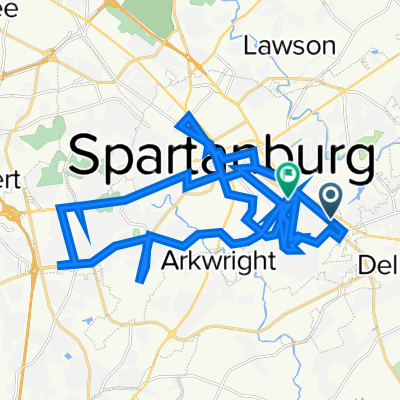
Duncan-Campobello-Boiling Springs
A cycling route starting in Spartanburg, South Carolina, United States.
Overview
About this route
- -:--
- Duration
- 99.9 km
- Distance
- 345 m
- Ascent
- 345 m
- Descent
- ---
- Avg. speed
- ---
- Max. altitude

Route quality
Waytypes & surfaces along the route
Waytypes
Road
46 km
(46 %)
Quiet road
22 km
(22 %)
Surfaces
Paved
91.9 km
(92 %)
Asphalt
89.9 km
(90 %)
Concrete
2 km
(2 %)
Undefined
8 km
(8 %)
Continue with Bikemap
Use, edit, or download this cycling route
You would like to ride Duncan-Campobello-Boiling Springs or customize it for your own trip? Here is what you can do with this Bikemap route:
Free features
- Save this route as favorite or in collections
- Copy & plan your own version of this route
- Split it into stages to create a multi-day tour
- Sync your route with Garmin or Wahoo
Premium features
Free trial for 3 days, or one-time payment. More about Bikemap Premium.
- Navigate this route on iOS & Android
- Export a GPX / KML file of this route
- Create your custom printout (try it for free)
- Download this route for offline navigation
Discover more Premium features.
Get Bikemap PremiumFrom our community
Other popular routes starting in Spartanburg
 Mary Black Rail Trail, Spartanburg to 351 E Henry St, Spartanburg
- Distance
- 12.7 km
- Ascent
- 120 m
- Descent
- 126 m
- Location
- Spartanburg, South Carolina, United States
 Mary Black Rail Trail, Spartanburg to Mary Black Rail Trail, Spartanburg
- Distance
- 4.1 km
- Ascent
- 20 m
- Descent
- 10 m
- Location
- Spartanburg, South Carolina, United States
 To the border and back v1.0
- Distance
- 71.8 km
- Ascent
- 301 m
- Descent
- 301 m
- Location
- Spartanburg, South Carolina, United States
 the usual
- Distance
- 3.8 km
- Ascent
- 50 m
- Descent
- 50 m
- Location
- Spartanburg, South Carolina, United States
 Duncan-Campobello-Boiling Springs
- Distance
- 99.9 km
- Ascent
- 345 m
- Descent
- 345 m
- Location
- Spartanburg, South Carolina, United States
 Restful route
- Distance
- 59.8 km
- Ascent
- 408 m
- Descent
- 388 m
- Location
- Spartanburg, South Carolina, United States
 woodland rail trail
- Distance
- 23.9 km
- Ascent
- 503 m
- Descent
- 515 m
- Location
- Spartanburg, South Carolina, United States
 a long route
- Distance
- 15.5 km
- Ascent
- 111 m
- Descent
- 111 m
- Location
- Spartanburg, South Carolina, United States
Open it in the app