

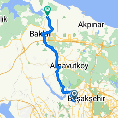
gökçetepe Tabiat parkı
A cycling route starting in Başakşehir, Istanbul, Republic of Türkiye.
Overview
About this route
- -:--
- Duration
- 259.4 km
- Distance
- 929 m
- Ascent
- 1,028 m
- Descent
- ---
- Avg. speed
- ---
- Max. altitude

Continue with Bikemap
Use, edit, or download this cycling route
You would like to ride gökçetepe Tabiat parkı or customize it for your own trip? Here is what you can do with this Bikemap route:
Free features
- Save this route as favorite or in collections
- Copy & plan your own version of this route
- Split it into stages to create a multi-day tour
- Sync your route with Garmin or Wahoo
Premium features
Free trial for 3 days, or one-time payment. More about Bikemap Premium.
- Navigate this route on iOS & Android
- Export a GPX / KML file of this route
- Create your custom printout (try it for free)
- Download this route for offline navigation
Discover more Premium features.
Get Bikemap PremiumFrom our community
Other popular routes starting in Başakşehir
 Ortaköy Sokak to Yıldırım Beyazıt Caddesi 19B
- Distance
- 7.7 km
- Ascent
- 117 m
- Descent
- 307 m
- Location
- Başakşehir, Istanbul, Republic of Türkiye
 Yıldırım Beyazıt Caddesi to Yıldırım Beyazıt Caddesi
- Distance
- 12.9 km
- Ascent
- 222 m
- Descent
- 251 m
- Location
- Başakşehir, Istanbul, Republic of Türkiye
 Ortaköy Sokak 15A to Yıldırım Beyazıt Caddesi
- Distance
- 12.2 km
- Ascent
- 225 m
- Descent
- 459 m
- Location
- Başakşehir, Istanbul, Republic of Türkiye
 Toki Kayabaşı Konutları 3 E to Toki Kayabaşı Konutları 3 E
- Distance
- 11.7 km
- Ascent
- 220 m
- Descent
- 252 m
- Location
- Başakşehir, Istanbul, Republic of Türkiye
 Dersan Sanayi Sitesi 102, İkitelli Osb to 81. Sokak 23
- Distance
- 13.3 km
- Ascent
- 250 m
- Descent
- 269 m
- Location
- Başakşehir, Istanbul, Republic of Türkiye
 Sular Vadisi
- Distance
- 5.8 km
- Ascent
- 70 m
- Descent
- 110 m
- Location
- Başakşehir, Istanbul, Republic of Türkiye
 Terkos
- Distance
- 35.3 km
- Ascent
- 598 m
- Descent
- 707 m
- Location
- Başakşehir, Istanbul, Republic of Türkiye
 Terkos Rota
- Distance
- 35.4 km
- Ascent
- 598 m
- Descent
- 710 m
- Location
- Başakşehir, Istanbul, Republic of Türkiye
Open it in the app