

Plzeňsko
A cycling route starting in Nepomuk, Plzeň Region, Czechia.
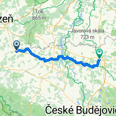
Overview
About this route
By car to the campsite in Nepomuk, approx. 400 km / 6 hours drive, set off in the morning or a day before after work 150 km, overnight at Fero's and continue 250 km in the morning. Traveling light, campsite in Nepomuk.
NW branch 105 km 1100 m
NE branch 120 km 1000 m
SW branch to Horažďovice by train, then 113 km 700 m
SE branch to Lnářov by train, then 100 km 300 m, from Blatná by train
- -:--
- Duration
- 437.2 km
- Distance
- 1,263 m
- Ascent
- 1,293 m
- Descent
- ---
- Avg. speed
- ---
- Max. altitude
Route quality
Waytypes & surfaces along the route
Waytypes
Road
192.4 km
(44 %)
Quiet road
87.4 km
(20 %)
Surfaces
Paved
91.8 km
(21 %)
Unpaved
21.9 km
(5 %)
Asphalt
87.4 km
(20 %)
Gravel
13.1 km
(3 %)
Continue with Bikemap
Use, edit, or download this cycling route
You would like to ride Plzeňsko or customize it for your own trip? Here is what you can do with this Bikemap route:
Free features
- Save this route as favorite or in collections
- Copy & plan your own version of this route
- Split it into stages to create a multi-day tour
- Sync your route with Garmin or Wahoo
Premium features
Free trial for 3 days, or one-time payment. More about Bikemap Premium.
- Navigate this route on iOS & Android
- Export a GPX / KML file of this route
- Create your custom printout (try it for free)
- Download this route for offline navigation
Discover more Premium features.
Get Bikemap PremiumFrom our community
Other popular routes starting in Nepomuk
 Nepomuk - Hluboka nad Vltavou
- Distance
- 101.9 km
- Ascent
- 456 m
- Descent
- 529 m
- Location
- Nepomuk, Plzeň Region, Czechia
 Na kole za zvířátky do Ždírce
- Distance
- 40.1 km
- Ascent
- 221 m
- Descent
- 408 m
- Location
- Nepomuk, Plzeň Region, Czechia
 Plzeňsko
- Distance
- 437.2 km
- Ascent
- 1,263 m
- Descent
- 1,293 m
- Location
- Nepomuk, Plzeň Region, Czechia
 Kadov, Bratronice
- Distance
- 134.5 km
- Ascent
- 590 m
- Descent
- 634 m
- Location
- Nepomuk, Plzeň Region, Czechia
 Nepomuk - Srby - Dubeč - Klášter - Nepomuk
- Distance
- 17.7 km
- Ascent
- 356 m
- Descent
- 356 m
- Location
- Nepomuk, Plzeň Region, Czechia
 Nepomuk - Tabor
- Distance
- 109.1 km
- Ascent
- 827 m
- Descent
- 828 m
- Location
- Nepomuk, Plzeň Region, Czechia
 Tojice - Plzeň terenní
- Distance
- 46.7 km
- Ascent
- 506 m
- Descent
- 610 m
- Location
- Nepomuk, Plzeň Region, Czechia
 Cizkov Dokola
- Distance
- 14.4 km
- Ascent
- 231 m
- Descent
- 232 m
- Location
- Nepomuk, Plzeň Region, Czechia
Open it in the app