- 23.6 km
- 216 m
- 302 m
- le Plateau, Quebec, Canada
Full-On Gats - 78km, 1,453m climbing
A cycling route starting in le Plateau, Quebec, Canada.
Overview
About this route
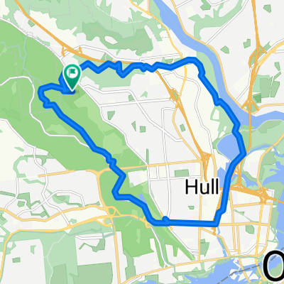
In Gatineau Park, from P1 at the south end, Gatineau Pkwy > Champlain Pkwy > Lac Fortune Pkwy > Gatineau Pkwy > Champlain Pkwy to Lookout. Then descend Champlain Pkwy to Gatineau Pkwy, left and repeat the Lac Fortune loop the other way, to Champlain Pkwy, finish by descending Champlain Pkwy > Gatineau Pkwy back to P1. All the road, all the hills, in both directions.
1,453m climbing (according to on-bike Garmin GPS). Trace mouse over elevation profile to see route and climbs.- -:--
- Duration
- 78.2 km
- Distance
- 808 m
- Ascent
- 808 m
- Descent
- ---
- Avg. speed
- ---
- Max. altitude
created this 15 years ago
Route quality
Waytypes & surfaces along the route
Waytypes
Road
77.4 km
(99 %)
Undefined
0.8 km
(1 %)
Surfaces
Paved
78.2 km
(100 %)
Asphalt
78.2 km
(100 %)
Route highlights
Points of interest along the route

Point of interest after 39.4 km
Champlain Lookout
Continue with Bikemap
Use, edit, or download this cycling route
You would like to ride Full-On Gats - 78km, 1,453m climbing or customize it for your own trip? Here is what you can do with this Bikemap route:
Free features
- Save this route as favorite or in collections
- Copy & plan your own version of this route
- Sync your route with Garmin or Wahoo
Premium features
Free trial for 3 days, or one-time payment. More about Bikemap Premium.
- Navigate this route on iOS & Android
- Export a GPX / KML file of this route
- Create your custom printout (try it for free)
- Download this route for offline navigation
Discover more Premium features.
Get Bikemap PremiumFrom our community
Other popular routes starting in le Plateau
- Trail 25, Chelsea to First Ave, Ottawa
- Gatineau Quyon Ottawa loop
- 127.7 km
- 567 m
- 569 m
- le Plateau, Quebec, Canada
- Rue de L'Équateur, Gatineau to Rue de L'Équateur, Gatineau
- 31.9 km
- 296 m
- 303 m
- le Plateau, Quebec, Canada
- Promenade de la Gatineau, Chelsea to Promenade de la Gatineau, Chelsea
- 1.2 km
- 36 m
- 41 m
- le Plateau, Quebec, Canada
- Work
- 12.7 km
- 42 m
- 68 m
- le Plateau, Quebec, Canada
- Relais Loop
- 19.9 km
- 201 m
- 201 m
- le Plateau, Quebec, Canada
- Rue des Obiers, Gatineau to Kichi Zībī Pky, Ottawa
- 19.6 km
- 44 m
- 101 m
- le Plateau, Quebec, Canada
- Full-On Gats - 78km, 1,453m climbing
- 78.2 km
- 808 m
- 808 m
- le Plateau, Quebec, Canada
Open it in the app


