

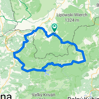
Orawa Cyklotrek Expedition
A cycling route starting in Rajcza, Silesian Voivodeship, Poland.
Overview
About this route
22.08.2013
- -:--
- Duration
- 210.1 km
- Distance
- 2,724 m
- Ascent
- 2,600 m
- Descent
- ---
- Avg. speed
- ---
- Max. altitude

Route quality
Waytypes & surfaces along the route
Waytypes
Road
77.7 km
(37 %)
Track
46.2 km
(22 %)
Surfaces
Paved
119.7 km
(57 %)
Unpaved
23.1 km
(11 %)
Asphalt
105 km
(50 %)
Ground
16.8 km
(8 %)
Continue with Bikemap
Use, edit, or download this cycling route
You would like to ride Orawa Cyklotrek Expedition or customize it for your own trip? Here is what you can do with this Bikemap route:
Free features
- Save this route as favorite or in collections
- Copy & plan your own version of this route
- Split it into stages to create a multi-day tour
- Sync your route with Garmin or Wahoo
Premium features
Free trial for 3 days, or one-time payment. More about Bikemap Premium.
- Navigate this route on iOS & Android
- Export a GPX / KML file of this route
- Create your custom printout (try it for free)
- Download this route for offline navigation
Discover more Premium features.
Get Bikemap PremiumFrom our community
Other popular routes starting in Rajcza
 Rajcza - Rycerzowa - Przegibek - Rajcza
- Distance
- 33.6 km
- Ascent
- 1,005 m
- Descent
- 1,003 m
- Location
- Rajcza, Silesian Voivodeship, Poland
 6.08.2011 @ Wyscig Rajcza Tour
- Distance
- 124.1 km
- Ascent
- 1,024 m
- Descent
- 1,024 m
- Location
- Rajcza, Silesian Voivodeship, Poland
 Wokół Wielkiej Raczy i Rycerzowej
- Distance
- 107.6 km
- Ascent
- 1,097 m
- Descent
- 1,097 m
- Location
- Rajcza, Silesian Voivodeship, Poland
![Kralova hola [lolowy wyjazd:D]](https://media.bikemap.net/routes/812056/staticmaps/in_7217f928-85ca-4297-9d46-492f4b3d14dc_400x400_bikemap-2021-3D-static.png) Kralova hola [lolowy wyjazd:D]
Kralova hola [lolowy wyjazd:D]- Distance
- 329.5 km
- Ascent
- 3,475 m
- Descent
- 3,120 m
- Location
- Rajcza, Silesian Voivodeship, Poland
 Rysianka przez Trzy Kopce
- Distance
- 36.3 km
- Ascent
- 1,087 m
- Descent
- 1,087 m
- Location
- Rajcza, Silesian Voivodeship, Poland
 Beskidy Przegibek - Wielka Racza
- Distance
- 59.8 km
- Ascent
- 1,445 m
- Descent
- 1,472 m
- Location
- Rajcza, Silesian Voivodeship, Poland
![RAJCZA TOUR`2011 plan trasy [6VIII]](https://media.bikemap.net/routes/1133459/staticmaps/in_ff24cec7-e7fd-4228-bdf1-b78e8fd397b5_400x400_bikemap-2021-3D-static.png) RAJCZA TOUR`2011 plan trasy [6VIII]
RAJCZA TOUR`2011 plan trasy [6VIII]- Distance
- 123 km
- Ascent
- 959 m
- Descent
- 960 m
- Location
- Rajcza, Silesian Voivodeship, Poland
 Rajcza - W.Rycerzowa - Rezerwat Oszast - Rajcza
- Distance
- 41.8 km
- Ascent
- 944 m
- Descent
- 943 m
- Location
- Rajcza, Silesian Voivodeship, Poland
Open it in the app