

T-gap and Sinton
A cycling route starting in Colorado Springs, Colorado, United States.
Overview
About this route
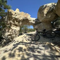
Park at Portal Park, T-gap trail east to Ranch, turn around and head SW to Rock Island, west to Pike's Peak Greenway, west on Sinton Trail to GG, return, north on PPG and T-Gap back to Portal Park.
- -:--
- Duration
- 24 km
- Distance
- 174 m
- Ascent
- 173 m
- Descent
- ---
- Avg. speed
- ---
- Max. altitude
Route quality
Waytypes & surfaces along the route
Waytypes
Path
14.9 km
(62 %)
Cycleway
6.5 km
(27 %)
Surfaces
Paved
19.7 km
(82 %)
Unpaved
1 km
(4 %)
Concrete
7.9 km
(33 %)
Paved (undefined)
6.2 km
(26 %)
Continue with Bikemap
Use, edit, or download this cycling route
You would like to ride T-gap and Sinton or customize it for your own trip? Here is what you can do with this Bikemap route:
Free features
- Save this route as favorite or in collections
- Copy & plan your own version of this route
- Sync your route with Garmin or Wahoo
Premium features
Free trial for 3 days, or one-time payment. More about Bikemap Premium.
- Navigate this route on iOS & Android
- Export a GPX / KML file of this route
- Create your custom printout (try it for free)
- Download this route for offline navigation
Discover more Premium features.
Get Bikemap PremiumFrom our community
Other popular routes starting in Colorado Springs
 Fundraise Ride Day 3 - 50 mi
- Distance
- 80.3 km
- Ascent
- 880 m
- Descent
- 879 m
- Location
- Colorado Springs, Colorado, United States
 to Red Rock via Midland trail
- Distance
- 20.2 km
- Ascent
- 127 m
- Descent
- 128 m
- Location
- Colorado Springs, Colorado, United States
 Pueblo fifty
- Distance
- 81.2 km
- Ascent
- 35 m
- Descent
- 501 m
- Location
- Colorado Springs, Colorado, United States
 lunch ride gold camp
- Distance
- 17 km
- Ascent
- 345 m
- Descent
- 347 m
- Location
- Colorado Springs, Colorado, United States
 Rockrimmon, Colorado Springs to Rockrimmon, Colorado Springs
- Distance
- 8.8 km
- Ascent
- 172 m
- Descent
- 174 m
- Location
- Colorado Springs, Colorado, United States
 Bear Creek Regional to Manitou
- Distance
- 19 km
- Ascent
- 355 m
- Descent
- 251 m
- Location
- Colorado Springs, Colorado, United States
 Lengthy ride through Colorado Springs
- Distance
- 35.4 km
- Ascent
- 248 m
- Descent
- 249 m
- Location
- Colorado Springs, Colorado, United States
 north trail
- Distance
- 49.2 km
- Ascent
- 469 m
- Descent
- 472 m
- Location
- Colorado Springs, Colorado, United States
Open it in the app