

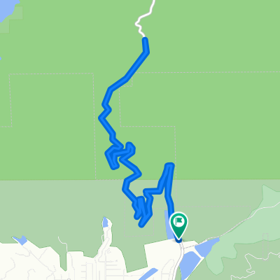
Glendora Mtn Rd to,East Fork & Back
A cycling route starting in Glendora, California, United States.
Overview
About this route
- 3 h 33 min
- Duration
- 53.5 km
- Distance
- 1,546 m
- Ascent
- 1,585 m
- Descent
- 15.1 km/h
- Avg. speed
- ---
- Max. altitude

Route photos


Route quality
Waytypes & surfaces along the route
Waytypes
Road
48.7 km
(91 %)
Quiet road
1.1 km
(2 %)
Surfaces
Paved
51.3 km
(96 %)
Paved (undefined)
48.7 km
(91 %)
Asphalt
2.7 km
(5 %)
Undefined
2.1 km
(4 %)
Continue with Bikemap
Use, edit, or download this cycling route
You would like to ride Glendora Mtn Rd to,East Fork & Back or customize it for your own trip? Here is what you can do with this Bikemap route:
Free features
- Save this route as favorite or in collections
- Copy & plan your own version of this route
- Sync your route with Garmin or Wahoo
Premium features
Free trial for 3 days, or one-time payment. More about Bikemap Premium.
- Navigate this route on iOS & Android
- Export a GPX / KML file of this route
- Create your custom printout (try it for free)
- Download this route for offline navigation
Discover more Premium features.
Get Bikemap PremiumFrom our community
Other popular routes starting in Glendora
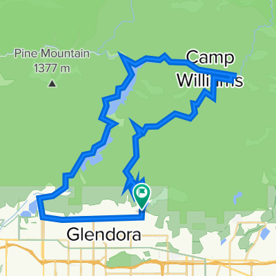
 1100 Glendora Mountain Rd, Glendora to 1100 Glendora Mountain Rd, Glendora
- Distance
- 15.6 km
- Ascent
- 438 m
- Descent
- 439 m
- Location
- Glendora, California, United States
 1100 Glendora Mountain Rd, Glendora to 1100 Glendora Mountain Rd, Glendora
- Distance
- 14.1 km
- Ascent
- 403 m
- Descent
- 407 m
- Location
- Glendora, California, United States
 1102–1108 Glendora Mountain Rd, Glendora to 1100 Glendora Mountain Rd, Glendora
- Distance
- 14.1 km
- Ascent
- 469 m
- Descent
- 474 m
- Location
- Glendora, California, United States
 1301–1399 E Palm Dr, Glendora to 910 Dalton Springs Ln, Glendora
- Distance
- 55.6 km
- Ascent
- 1,248 m
- Descent
- 1,249 m
- Location
- Glendora, California, United States
 glendora-azusa
- Distance
- 55.1 km
- Ascent
- 1,023 m
- Descent
- 1,024 m
- Location
- Glendora, California, United States
 1600 E Foothill Blvd, Glendora to 1600 E Foothill Blvd, Glendora
- Distance
- 22.1 km
- Ascent
- 439 m
- Descent
- 485 m
- Location
- Glendora, California, United States
 Glendora to Azusa
- Distance
- 17.5 km
- Ascent
- 366 m
- Descent
- 586 m
- Location
- Glendora, California, United States
 Glendora Mtn Rd to,East Fork & Back
- Distance
- 53.5 km
- Ascent
- 1,546 m
- Descent
- 1,585 m
- Location
- Glendora, California, United States
Open it in the app