

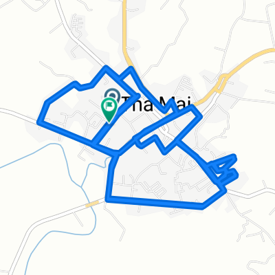
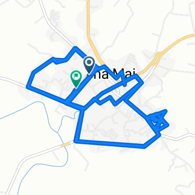
Overview
About this route
- -:--
- Duration
- 91.8 km
- Distance
- 371 m
- Ascent
- 197 m
- Descent
- ---
- Avg. speed
- ---
- Max. altitude
Part of
Thailand
4 stages
Route quality
Waytypes & surfaces along the route
Waytypes
Quiet road
30.3 km
(33 %)
Road
20.2 km
(22 %)
Surfaces
Paved
10.1 km
(11 %)
Unpaved
0.9 km
(1 %)
Asphalt
10.1 km
(11 %)
Unpaved (undefined)
0.9 km
(1 %)
Undefined
80.8 km
(88 %)
Continue with Bikemap
Use, edit, or download this cycling route
You would like to ride Chao Lao - Pong Nam Ron or customize it for your own trip? Here is what you can do with this Bikemap route:
Free features
- Save this route as favorite or in collections
- Copy & plan your own version of this route
- Split it into stages to create a multi-day tour
- Sync your route with Garmin or Wahoo
Premium features
Free trial for 3 days, or one-time payment. More about Bikemap Premium.
- Navigate this route on iOS & Android
- Export a GPX / KML file of this route
- Create your custom printout (try it for free)
- Download this route for offline navigation
Discover more Premium features.
Get Bikemap PremiumFrom our community
Other popular routes starting in Tha Mai
 Thetsabal Sai ถนน to Thetsabal Sai ถนน
- Distance
- 20.9 km
- Ascent
- 188 m
- Descent
- 165 m
- Location
- Tha Mai, Chanthaburi, Thailand
 Thetsabal Sai ถนน to Thetsabal Sai ถนน
- Distance
- 20.1 km
- Ascent
- 155 m
- Descent
- 127 m
- Location
- Tha Mai, Chanthaburi, Thailand
 Thetsabal Sai ถนน to Thetsabal Sai ถนน
- Distance
- 19.9 km
- Ascent
- 174 m
- Descent
- 154 m
- Location
- Tha Mai, Chanthaburi, Thailand
 Thetsabal Sai ถนน to Thetsabal Sai ถนน
- Distance
- 21.2 km
- Ascent
- 123 m
- Descent
- 109 m
- Location
- Tha Mai, Chanthaburi, Thailand
 Chanchaolao Beach Resort to Koh Chang
- Distance
- 128 km
- Ascent
- 87 m
- Descent
- 81 m
- Location
- Tha Mai, Chanthaburi, Thailand
 Thetsabal Sai ถนน to Thetsabal Sai
- Distance
- 23.8 km
- Ascent
- 135 m
- Descent
- 120 m
- Location
- Tha Mai, Chanthaburi, Thailand
 จันทบุรี 50 กม.
- Distance
- 53.8 km
- Ascent
- 165 m
- Descent
- 167 m
- Location
- Tha Mai, Chanthaburi, Thailand
 Thetsabal Sai ถนน to Thetsabal Sai
- Distance
- 21.4 km
- Ascent
- 205 m
- Descent
- 188 m
- Location
- Tha Mai, Chanthaburi, Thailand
Open it in the app