

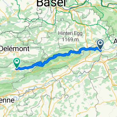
Scheltenpass mit Weissenstein
A cycling route starting in Olten, Canton of Solothurn, Switzerland.
Overview
About this route
Zweimal 500m rauf, erst auf 10km und am Schluss den Weissenstein auf 5 km.
- -:--
- Duration
- 79.6 km
- Distance
- 1,597 m
- Ascent
- 1,558 m
- Descent
- ---
- Avg. speed
- ---
- Max. altitude

Route quality
Waytypes & surfaces along the route
Waytypes
Road
32.6 km
(41 %)
Busy road
26 km
(33 %)
Surfaces
Paved
40.4 km
(51 %)
Unpaved
1.5 km
(2 %)
Asphalt
38.2 km
(48 %)
Paved (undefined)
2.2 km
(3 %)
Continue with Bikemap
Use, edit, or download this cycling route
You would like to ride Scheltenpass mit Weissenstein or customize it for your own trip? Here is what you can do with this Bikemap route:
Free features
- Save this route as favorite or in collections
- Copy & plan your own version of this route
- Sync your route with Garmin or Wahoo
Premium features
Free trial for 3 days, or one-time payment. More about Bikemap Premium.
- Navigate this route on iOS & Android
- Export a GPX / KML file of this route
- Create your custom printout (try it for free)
- Download this route for offline navigation
Discover more Premium features.
Get Bikemap PremiumFrom our community
Other popular routes starting in Olten
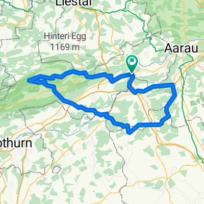
 Olten - Hauenstein - Schaafmatt - Olten
- Distance
- 31.5 km
- Ascent
- 652 m
- Descent
- 655 m
- Location
- Olten, Canton of Solothurn, Switzerland
 Grenchenberg Corcelles Schelten
- Distance
- 149 km
- Ascent
- 2,318 m
- Descent
- 2,318 m
- Location
- Olten, Canton of Solothurn, Switzerland
 Schützenmattweg 12, Olten nach Forstackerstrasse 4F, Zofingen
- Distance
- 10 km
- Ascent
- 84 m
- Descent
- 38 m
- Location
- Olten, Canton of Solothurn, Switzerland
 Schafmattrunde Olten
- Distance
- 37.3 km
- Ascent
- 909 m
- Descent
- 890 m
- Location
- Olten, Canton of Solothurn, Switzerland
 Olten - Moutier
- Distance
- 58.8 km
- Ascent
- 2,201 m
- Descent
- 1,802 m
- Location
- Olten, Canton of Solothurn, Switzerland
 20151113 AG/BL/SO-Combo
- Distance
- 60.1 km
- Ascent
- 1,419 m
- Descent
- 1,419 m
- Location
- Olten, Canton of Solothurn, Switzerland
 Scheltenpass mit Weissenstein
- Distance
- 79.6 km
- Ascent
- 1,597 m
- Descent
- 1,558 m
- Location
- Olten, Canton of Solothurn, Switzerland
 Olten - Mümliswil - Brunnersberg - Kestenholz
- Distance
- 93.5 km
- Ascent
- 1,455 m
- Descent
- 1,454 m
- Location
- Olten, Canton of Solothurn, Switzerland
Open it in the app