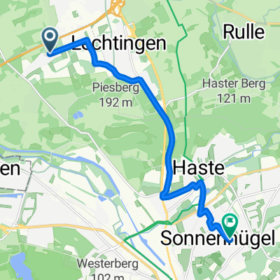
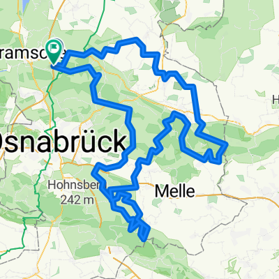
Team Rynkeby 2019 von Wallenhorst bis Bocholt neu
A cycling route starting in Wallenhorst, Lower Saxony, Germany.
Overview
About this route
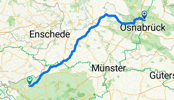
New route Sevetal Wallenhorst bis Bocholt
- -:--
- Duration
- 140.3 km
- Distance
- 110 m
- Ascent
- 174 m
- Descent
- ---
- Avg. speed
- ---
- Avg. speed
Route photos
Route quality
Waytypes & surfaces along the route
Waytypes
Path
54.6 km
(39 %)
Busy road
36.6 km
(26 %)
Surfaces
Paved
107 km
(76 %)
Unpaved
0.4 km
(<1 %)
Asphalt
97.3 km
(69 %)
Paved (undefined)
5 km
(4 %)
Continue with Bikemap
Use, edit, or download this cycling route
You would like to ride Team Rynkeby 2019 von Wallenhorst bis Bocholt neu or customize it for your own trip? Here is what you can do with this Bikemap route:
Free features
- Save this route as favorite or in collections
- Copy & plan your own version of this route
- Split it into stages to create a multi-day tour
- Sync your route with Garmin or Wahoo
Premium features
Free trial for 3 days, or one-time payment. More about Bikemap Premium.
- Navigate this route on iOS & Android
- Export a GPX / KML file of this route
- Create your custom printout (try it for free)
- Download this route for offline navigation
Discover more Premium features.
Get Bikemap PremiumFrom our community
Other popular routes starting in Wallenhorst
- Piesberg
- Distance
- 18 km
- Ascent
- 146 m
- Descent
- 188 m
- Location
- Wallenhorst, Lower Saxony, Germany
- Lechtingen , Rulle , Nettetal , Haste , Lechtingen
- Distance
- 15.1 km
- Ascent
- 91 m
- Descent
- 91 m
- Location
- Wallenhorst, Lower Saxony, Germany
- Kleine Runde
- Distance
- 32.5 km
- Ascent
- 109 m
- Descent
- 108 m
- Location
- Wallenhorst, Lower Saxony, Germany
- Rulle-Sichkanal-Lechtingen-Rulle
- Distance
- 32.1 km
- Ascent
- 147 m
- Descent
- 147 m
- Location
- Wallenhorst, Lower Saxony, Germany
- Rulle- Vpn der Stadt bis zur Bauernschaft
- Distance
- 43.2 km
- Ascent
- 241 m
- Descent
- 230 m
- Location
- Wallenhorst, Lower Saxony, Germany
- Lindholzweg, Osnabrück nach Lindholzweg, Osnabrück
- Distance
- 37.3 km
- Ascent
- 237 m
- Descent
- 237 m
- Location
- Wallenhorst, Lower Saxony, Germany
- RTF Engter 75 km
- Distance
- 72.1 km
- Ascent
- 318 m
- Descent
- 318 m
- Location
- Wallenhorst, Lower Saxony, Germany
- Wallenhorster Route
- Distance
- 20 km
- Ascent
- 102 m
- Descent
- 97 m
- Location
- Wallenhorst, Lower Saxony, Germany
Open it in the app