

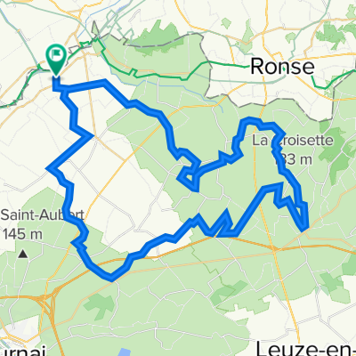
Kriereroute
A cycling route starting in Avelgem, Flemish Region, Belgium.
Overview
About this route
The route starts at the sports center Ter Muncken (with changing and shower facilities), is 45 kilometers long of which 47% is off-road and has the following scores:
general difficulty: 3 out of 5
technical difficulty: 2 out of 5
altitude gain: 2 out of 5
Through connecting routes, it is also possible to connect to other mountain biking routes in the region such as:
the Sport Vlaanderen route Zwevegem (35 km)
the Boerhoven route (37 km)
the Sport Vlaanderen route Kluisbergen (11.5 km).
- -:--
- Duration
- 45.6 km
- Distance
- 41 m
- Ascent
- 41 m
- Descent
- ---
- Avg. speed
- ---
- Max. altitude
Route quality
Waytypes & surfaces along the route
Waytypes
Quiet road
16.4 km
(36 %)
Path
13.2 km
(29 %)
Surfaces
Paved
21 km
(46 %)
Unpaved
8.7 km
(19 %)
Asphalt
17.3 km
(38 %)
Concrete
3.6 km
(8 %)
Continue with Bikemap
Use, edit, or download this cycling route
You would like to ride Kriereroute or customize it for your own trip? Here is what you can do with this Bikemap route:
Free features
- Save this route as favorite or in collections
- Copy & plan your own version of this route
- Sync your route with Garmin or Wahoo
Premium features
Free trial for 3 days, or one-time payment. More about Bikemap Premium.
- Navigate this route on iOS & Android
- Export a GPX / KML file of this route
- Create your custom printout (try it for free)
- Download this route for offline navigation
Discover more Premium features.
Get Bikemap PremiumFrom our community
Other popular routes starting in Avelgem
 avelgem2 - 62.5
- Distance
- 62.5 km
- Ascent
- 521 m
- Descent
- 521 m
- Location
- Avelgem, Flemish Region, Belgium
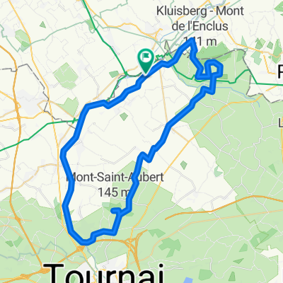 st aubert et kluisberg
- Distance
- 50.9 km
- Ascent
- 283 m
- Descent
- 283 m
- Location
- Avelgem, Flemish Region, Belgium
 oudenaarde
- Distance
- 38.7 km
- Ascent
- 94 m
- Descent
- 94 m
- Location
- Avelgem, Flemish Region, Belgium
 avelgem1 - 61.9
- Distance
- 61.9 km
- Ascent
- 392 m
- Descent
- 391 m
- Location
- Avelgem, Flemish Region, Belgium
 FIANDRE 2020
- Distance
- 40.4 km
- Ascent
- 424 m
- Descent
- 423 m
- Location
- Avelgem, Flemish Region, Belgium
 Toertocht Jowan
- Distance
- 47.3 km
- Ascent
- 766 m
- Descent
- 766 m
- Location
- Avelgem, Flemish Region, Belgium
 Otegem - Geraardsbergen - Otegem
- Distance
- 104 km
- Ascent
- 666 m
- Descent
- 660 m
- Location
- Avelgem, Flemish Region, Belgium
 Pays des Collines
- Distance
- 160.7 km
- Ascent
- 2,577 m
- Descent
- 2,579 m
- Location
- Avelgem, Flemish Region, Belgium
Open it in the app