

Trainspotting 2
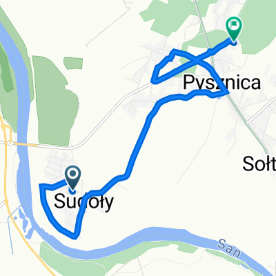
A cycling route starting in Pysznica, Subcarpathian Voivodeship, Poland.
Overview
About this route
- -:--
- Duration
- 189.7 km
- Distance
- 383 m
- Ascent
- 385 m
- Descent
- ---
- Avg. speed
- ---
- Max. altitude
Route quality
Waytypes & surfaces along the route
Waytypes
Quiet road
111.9 km
(59 %)
Road
37.9 km
(20 %)
Surfaces
Paved
130.9 km
(69 %)
Unpaved
9.5 km
(5 %)
Asphalt
130.9 km
(69 %)
Ground
5.7 km
(3 %)
Continue with Bikemap
Use, edit, or download this cycling route
You would like to ride Trainspotting 2 or customize it for your own trip? Here is what you can do with this Bikemap route:
Free features
- Save this route as favorite or in collections
- Copy & plan your own version of this route
- Split it into stages to create a multi-day tour
- Sync your route with Garmin or Wahoo
Premium features
Free trial for 3 days, or one-time payment. More about Bikemap Premium.
- Navigate this route on iOS & Android
- Export a GPX / KML file of this route
- Create your custom printout (try it for free)
- Download this route for offline navigation
Discover more Premium features.
Get Bikemap PremiumFrom our community
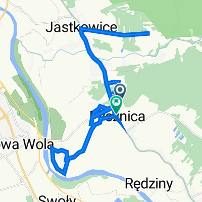
Other popular routes starting in Pysznica
 Wykonać niemożliwe...
- Distance
- 50.2 km
- Ascent
- 99 m
- Descent
- 99 m
- Location
- Pysznica, Subcarpathian Voivodeship, Poland
 Pysznica - Radomyśl - Kępie Zaleszańskie - Stalowa Wola - Pysznica
- Distance
- 53.4 km
- Ascent
- 26 m
- Descent
- 27 m
- Location
- Pysznica, Subcarpathian Voivodeship, Poland
 Błonie 32, Pysznica do Modrzewiowa 19, Pysznica
- Distance
- 7.8 km
- Ascent
- 26 m
- Descent
- 20 m
- Location
- Pysznica, Subcarpathian Voivodeship, Poland
 Po drożach i bezdrożach Lasów Janowskich (+ Bomba)
- Distance
- 88.2 km
- Ascent
- 114 m
- Descent
- 115 m
- Location
- Pysznica, Subcarpathian Voivodeship, Poland
 Modrzewiowa 12, Pysznica do Wolności 388, Pysznica
- Distance
- 28 km
- Ascent
- 97 m
- Descent
- 99 m
- Location
- Pysznica, Subcarpathian Voivodeship, Poland
 noworocznie po okolicy
- Distance
- 40.2 km
- Ascent
- 89 m
- Descent
- 88 m
- Location
- Pysznica, Subcarpathian Voivodeship, Poland
 22.05
22.05- Distance
- 78.3 km
- Ascent
- 55 m
- Descent
- 56 m
- Location
- Pysznica, Subcarpathian Voivodeship, Poland
 Imielity Ług od drugiej strony
- Distance
- 47 km
- Ascent
- 87 m
- Descent
- 87 m
- Location
- Pysznica, Subcarpathian Voivodeship, Poland
Open it in the app