

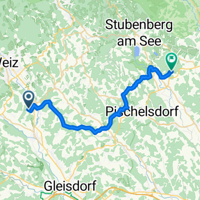
Ost - Weststeiermark
A cycling route starting in Unterfladnitz, Styria, Austria.
Overview
About this route
Pleasant to ride, mostly on side roads, little traffic, with a few short climbs (Laßnitztal, Wundschuh, Pöls, Gantschenberg, Stainz - Bad Gams). For those who want to go further: e.g., through Frauental (Konditorei Leitner!!) to Deutschlandsberg.
- -:--
- Duration
- 71.7 km
- Distance
- 415 m
- Ascent
- 431 m
- Descent
- ---
- Avg. speed
- ---
- Max. altitude
Route quality
Waytypes & surfaces along the route
Waytypes
Quiet road
10 km
(14 %)
Cycleway
9.3 km
(13 %)
Surfaces
Paved
43.7 km
(61 %)
Unpaved
4.3 km
(6 %)
Asphalt
43 km
(60 %)
Unpaved (undefined)
2.9 km
(4 %)
Continue with Bikemap
Use, edit, or download this cycling route
You would like to ride Ost - Weststeiermark or customize it for your own trip? Here is what you can do with this Bikemap route:
Free features
- Save this route as favorite or in collections
- Copy & plan your own version of this route
- Sync your route with Garmin or Wahoo
Premium features
Free trial for 3 days, or one-time payment. More about Bikemap Premium.
- Navigate this route on iOS & Android
- Export a GPX / KML file of this route
- Create your custom printout (try it for free)
- Download this route for offline navigation
Discover more Premium features.
Get Bikemap PremiumFrom our community
Other popular routes starting in Unterfladnitz
 SR Fieberbründl
- Distance
- 24.8 km
- Ascent
- 534 m
- Descent
- 595 m
- Location
- Unterfladnitz, Styria, Austria
 Gemütliche Route in St. Ruprecht an der Raab
- Distance
- 46.4 km
- Ascent
- 1,418 m
- Descent
- 1,451 m
- Location
- Unterfladnitz, Styria, Austria
 Ilztalradweg Kontrollstrecke
- Distance
- 11.2 km
- Ascent
- 161 m
- Descent
- 237 m
- Location
- Unterfladnitz, Styria, Austria
 Breitegg Heimwirt Pircha Klettendorf Preding Breitegg
- Distance
- 22.2 km
- Ascent
- 570 m
- Descent
- 573 m
- Location
- Unterfladnitz, Styria, Austria
 Buschenschanktour
- Distance
- 45.7 km
- Ascent
- 879 m
- Descent
- 879 m
- Location
- Unterfladnitz, Styria, Austria
 Ost - Weststeiermark
- Distance
- 71.7 km
- Ascent
- 415 m
- Descent
- 431 m
- Location
- Unterfladnitz, Styria, Austria
 Breitegg Arndorf Lohnberg Schirnitz Etzersdorf Preding Breitegg
- Distance
- 24.7 km
- Ascent
- 482 m
- Descent
- 482 m
- Location
- Unterfladnitz, Styria, Austria
 Gemütliche Route in Weiz Umgebung
- Distance
- 25.1 km
- Ascent
- 409 m
- Descent
- 410 m
- Location
- Unterfladnitz, Styria, Austria
Open it in the app