

Gigny-sur-Saône- Chalon-sur-Saône
A cycling route starting in Simandre, Bourgogne-Franche-Comté, France.
Overview
About this route
- 4 h
- Duration
- 45.9 km
- Distance
- 97 m
- Ascent
- 94 m
- Descent
- 11.5 km/h
- Avg. speed
- ---
- Max. altitude
Route photos

Route quality
Waytypes & surfaces along the route
Waytypes
Path
14.9 km
(33 %)
Quiet road
10 km
(22 %)
Surfaces
Paved
22.4 km
(49 %)
Unpaved
11.4 km
(25 %)
Asphalt
20.1 km
(44 %)
Ground
5.9 km
(13 %)
Continue with Bikemap
Use, edit, or download this cycling route
You would like to ride Gigny-sur-Saône- Chalon-sur-Saône or customize it for your own trip? Here is what you can do with this Bikemap route:
Free features
- Save this route as favorite or in collections
- Copy & plan your own version of this route
- Sync your route with Garmin or Wahoo
Premium features
Free trial for 3 days, or one-time payment. More about Bikemap Premium.
- Navigate this route on iOS & Android
- Export a GPX / KML file of this route
- Create your custom printout (try it for free)
- Download this route for offline navigation
Discover more Premium features.
Get Bikemap PremiumFrom our community
Other popular routes starting in Simandre
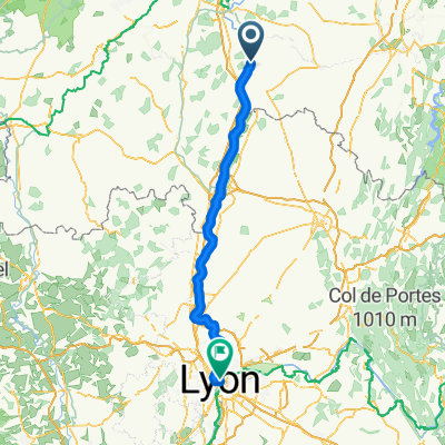 Simandre - Lyon
- Distance
- 121.4 km
- Ascent
- 340 m
- Descent
- 326 m
- Location
- Simandre, Bourgogne-Franche-Comté, France
 Gigny-sur-Saône- Chalon-sur-Saône
- Distance
- 45.9 km
- Ascent
- 97 m
- Descent
- 94 m
- Location
- Simandre, Bourgogne-Franche-Comté, France
 Velotour Burgund_03. Tag
- Distance
- 58 km
- Ascent
- 120 m
- Descent
- 126 m
- Location
- Simandre, Bourgogne-Franche-Comté, France
 gigny-sur-saône / la bruyère
- Distance
- 74.1 km
- Ascent
- 47 m
- Descent
- 40 m
- Location
- Simandre, Bourgogne-Franche-Comté, France
 fjfjfk
- Distance
- 21.7 km
- Ascent
- 36 m
- Descent
- 31 m
- Location
- Simandre, Bourgogne-Franche-Comté, France
 20150724_110411.gpx
- Distance
- 30.6 km
- Ascent
- 112 m
- Descent
- 119 m
- Location
- Simandre, Bourgogne-Franche-Comté, France
 Rue du Château 6, Gigny-sur-Saône nach Route de l'Abergement 31, Ouroux-sur-Saône
- Distance
- 36.8 km
- Ascent
- 166 m
- Descent
- 148 m
- Location
- Simandre, Bourgogne-Franche-Comté, France
 13. Tag Gigny-sur-Saône - Crêches-sur-Saône
- Distance
- 56.6 km
- Ascent
- 135 m
- Descent
- 142 m
- Location
- Simandre, Bourgogne-Franche-Comté, France
Open it in the app