Bötzingen Schwimmbad
- 20.1 km
- 54 m
- 53 m
- Umkirch, Baden-Wurttemberg, Germany
A cycling route starting in Umkirch, Baden-Wurttemberg, Germany.
Overview
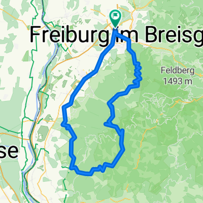
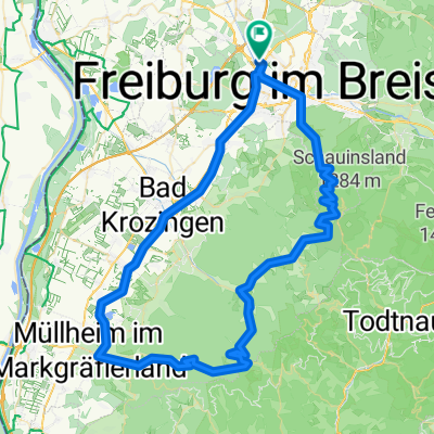
SvO_2019-05-31
Trainingsrunde vom SvO-Rieselfeld vom 31.Mai 2019:
Frbg-Rieselfeld - Lehen - Umkirch - Gottenheim - Bötzingen - Vogelsangpass - Vogtsburg - Schelingen - Silberbrunnen (Bahlingen) - Eichstetten - Bötzingen - Gottenheim - Tuniberghöhenweg - Opfingen - St.Nikolaus - Waltershofen - Umkirch - Mundenhof - Rieselfeld
created this 6 years ago
Route quality
Quiet road
22.5 km
(40 %)
Track
16.9 km
(30 %)
Paved
52.4 km
(93 %)
Asphalt
46.7 km
(83 %)
Paved (undefined)
5.6 km
(10 %)
Undefined
3.9 km
(7 %)
Continue with Bikemap
You would like to ride SvO_2019-05-31 or customize it for your own trip? Here is what you can do with this Bikemap route:
Free trial for 3 days, or one-time payment. More about Bikemap Premium.
Discover more Premium features.
Get Bikemap PremiumFrom our community
Open it in the app