
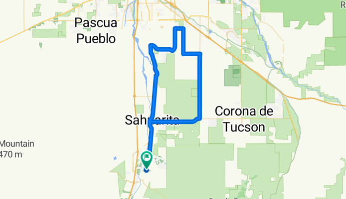
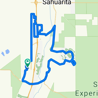
Madera Highlands to South Tucson loop via Wilmont
A cycling route starting in Green Valley, Arizona, United States.
Overview
About this route
- -:--
- Duration
- 76.9 km
- Distance
- 133 m
- Ascent
- 135 m
- Descent
- ---
- Avg. speed
- ---
- Max. altitude

Route quality
Waytypes & surfaces along the route
Waytypes
Road
22.3 km
(29 %)
Quiet road
5.4 km
(7 %)
Surfaces
Paved
24.6 km
(32 %)
Unpaved
2.3 km
(3 %)
Asphalt
20.8 km
(27 %)
Paved (undefined)
3.8 km
(5 %)
Continue with Bikemap
Use, edit, or download this cycling route
You would like to ride Madera Highlands to South Tucson loop via Wilmont or customize it for your own trip? Here is what you can do with this Bikemap route:
Free features
- Save this route as favorite or in collections
- Copy & plan your own version of this route
- Sync your route with Garmin or Wahoo
Premium features
Free trial for 3 days, or one-time payment. More about Bikemap Premium.
- Navigate this route on iOS & Android
- Export a GPX / KML file of this route
- Create your custom printout (try it for free)
- Download this route for offline navigation
Discover more Premium features.
Get Bikemap PremiumFrom our community
Other popular routes starting in Green Valley
 Continental/Mission to Helmet Peak
- Distance
- 38.9 km
- Ascent
- 235 m
- Descent
- 238 m
- Location
- Green Valley, Arizona, United States
 NE-130316 - Tucson Bicycle Classic - Stage 01
- Distance
- 33.2 km
- Ascent
- 236 m
- Descent
- 236 m
- Location
- Green Valley, Arizona, United States
 Doug's GV Ramble
- Distance
- 43.8 km
- Ascent
- 151 m
- Descent
- 153 m
- Location
- Green Valley, Arizona, United States
 Canoa Hills (backwards)
- Distance
- 25 km
- Ascent
- 109 m
- Descent
- 111 m
- Location
- Green Valley, Arizona, United States
 S Helvetia Rd, Sonoita to Road 411, Sahuarita
- Distance
- 9.9 km
- Ascent
- 142 m
- Descent
- 144 m
- Location
- Green Valley, Arizona, United States
 749 N Rugged Canyon Dr, Green Valley to 121 W Calle Nogal, Green Valley
- Distance
- 4.7 km
- Ascent
- 17 m
- Descent
- 68 m
- Location
- Green Valley, Arizona, United States
 720 N Observation Trail, Green Valley to E Sam Lena Dr, Tucson
- Distance
- 70.3 km
- Ascent
- 227 m
- Descent
- 367 m
- Location
- Green Valley, Arizona, United States
 121 W Calle Nogal, Green Valley to 748 N Cedar Bend Ave, Green Valley
- Distance
- 10.1 km
- Ascent
- 75 m
- Descent
- 58 m
- Location
- Green Valley, Arizona, United States
Open it in the app