Transalp 2012. Day 03. Eng - Mayrhofen
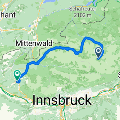
- 61.9 km
- 657 m
- 1,250 m
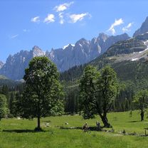
- Gnadenwald, Tyrol, Austria
2029 Busradtour
A cycling route starting in Gnadenwald, Tyrol, Austria.
Overview
Wir fahren mit dem Bus und Fahrradanhänger über Bad Tölz–Lenggries–Sylvensteinspeicher in die Eng (Ahornboden).
Um 6:00 Uhr Verladen der Räder
Um 6:30 Uhr Abfahrt
Um 9:30 Uhr Ankunft in der Eng
Von 9:30 - 10:00 Uhr Kaffepause
Um 10:00 Uhr Abfahrt mit den Rädern in Richtung Vorderriss bis Fall, wo wir Mittagspause machen.
Outdoorhotel Jäger von Fall
Ludwig-Ganghofer-Straße 8, in Fall
Tel.: +49 (0) 8045 - 130
Um 14:00 Uhr weiterfahrt nach Lenggries wo der Bus auf uns wartet. Abfahrt mit dem Bus nach Wörth um 16:30 Uhr. Bitte erst die Räder in den Bus verladen, dann Cafe aufsuchen.
Mit den Abfahrtszeiten müssen wir uns nach dem Busfahrer richten!
created this 6 years ago
Part of

2029 Busradtour
1 stage


Route quality
Road
24.7 km
(51 %)
Cycleway
9.7 km
(20 %)
Paved
46 km
(95 %)
Unpaved
1.9 km
(4 %)
Asphalt
46 km
(95 %)
Loose gravel
1 km
(2 %)
Continue with Bikemap
You would like to ride Eng-Fall-Sylvensteinsee-Lenggries_20190602 or customize it for your own trip? Here is what you can do with this Bikemap route:
Free trial for 3 days, or one-time payment. More about Bikemap Premium.
Discover more Premium features.
Get Bikemap PremiumFrom our community
Open it in the app