

kingdom
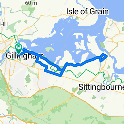
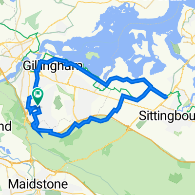
A cycling route starting in Chatham, England, United Kingdom.
Overview
About this route
- -:--
- Duration
- 85.1 km
- Distance
- 781 m
- Ascent
- 781 m
- Descent
- ---
- Avg. speed
- ---
- Max. altitude

Route quality
Waytypes & surfaces along the route
Waytypes
Road
37.5 km
(44 %)
Quiet road
21.3 km
(25 %)
Surfaces
Paved
46.8 km
(55 %)
Asphalt
46 km
(54 %)
Paved (undefined)
0.9 km
(1 %)
Undefined
38.3 km
(45 %)
Route highlights
Points of interest along the route
Point of interest after 42.6 km
kingdom cafe
Continue with Bikemap
Use, edit, or download this cycling route
You would like to ride kingdom or customize it for your own trip? Here is what you can do with this Bikemap route:
Free features
- Save this route as favorite or in collections
- Copy & plan your own version of this route
- Split it into stages to create a multi-day tour
- Sync your route with Garmin or Wahoo
Premium features
Free trial for 3 days, or one-time payment. More about Bikemap Premium.
- Navigate this route on iOS & Android
- Export a GPX / KML file of this route
- Create your custom printout (try it for free)
- Download this route for offline navigation
Discover more Premium features.
Get Bikemap PremiumFrom our community
Other popular routes starting in Chatham
 Sheppy Bridge
- Distance
- 40.3 km
- Ascent
- 189 m
- Descent
- 189 m
- Location
- Chatham, England, United Kingdom
 country route
- Distance
- 80.9 km
- Ascent
- 588 m
- Descent
- 588 m
- Location
- Chatham, England, United Kingdom
 ROF 2017 UK Pt2
- Distance
- 83 km
- Ascent
- 364 m
- Descent
- 369 m
- Location
- Chatham, England, United Kingdom
 hartlip
- Distance
- 34.7 km
- Ascent
- 236 m
- Descent
- 236 m
- Location
- Chatham, England, United Kingdom
 Gillingham Bredhurst Iwade
- Distance
- 48.6 km
- Ascent
- 291 m
- Descent
- 290 m
- Location
- Chatham, England, United Kingdom
 West Malling
- Distance
- 42.5 km
- Ascent
- 357 m
- Descent
- 386 m
- Location
- Chatham, England, United Kingdom
 kingdom
- Distance
- 85.1 km
- Ascent
- 781 m
- Descent
- 781 m
- Location
- Chatham, England, United Kingdom
 158 Walderslade Road, Chatham to 158 Walderslade Road, Chatham
- Distance
- 53.2 km
- Ascent
- 3,813 m
- Descent
- 3,813 m
- Location
- Chatham, England, United Kingdom
Open it in the app