


Brotherly love
- 13.8 km
- 55 m
- 57 m
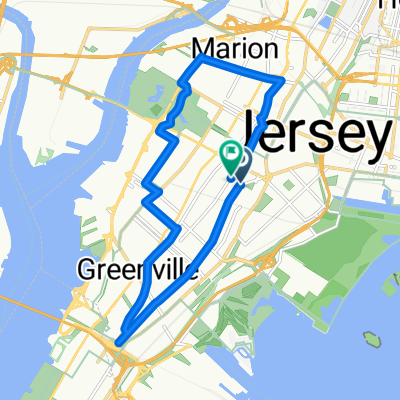
- Jersey City, New Jersey, United States
A cycling route starting in Jersey City, New Jersey, United States.
Overview
Jersey City, NJ
Bayonne Bridge to Staten Island
Graniteville Quarry Park
Supreme Chocolatier [Snack, Tour]
Fresh Kills Park [Birbs]
Staten Island Boat Graveyard
Donut World [Snack]
Todt Hill
Enoteca Maria [Food]
St. George's Ferry Terminal to NYC
created this 6 years ago
Route quality
Road
18.4 km
(47 %)
Quiet road
8.6 km
(22 %)
Paved
23.5 km
(60 %)
Asphalt
19.6 km
(50 %)
Concrete
3.1 km
(8 %)
Route highlights
Enoteca Maria (Food)
99 Sumner Pl - Open House [1-3p]
60 Marion Ave Open House [12-2p]
142 N Burgher Ave - Open House [1-3p]
Bayonne Bridge is apparently open now?
87 Treadwell Ave - Open House [1-3p]
37 Giordan Ct [Open House 3-3:30]
Enoteca Maria
Graniteville Quarry Park
Supreme Chocolatier
Fresh Kills; strange dearth of pedestrian / bike maps. Lots of birbs.
Staten Island Boat Graveyard
Donut World
Continue with Bikemap
You would like to ride Supreme Chocolates, Dead Ships, Live Ferries or customize it for your own trip? Here is what you can do with this Bikemap route:
Free trial for 3 days, or one-time payment. More about Bikemap Premium.
Discover more Premium features.
Get Bikemap PremiumFrom our community
Open it in the app


