

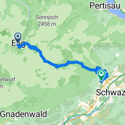
Gnadenwald Rumer Alm
A cycling route starting in Gnadenwald, Tyrol, Austria.
Overview
About this route
Gnadenwald Arzler Alm and the same route back, 880 meters of elevation in total.
- -:--
- Duration
- 25.4 km
- Distance
- 614 m
- Ascent
- 432 m
- Descent
- ---
- Avg. speed
- ---
- Max. altitude

Route photos


Route quality
Waytypes & surfaces along the route
Waytypes
Track
7.6 km
(30 %)
Quiet road
4.1 km
(16 %)
Surfaces
Paved
12.7 km
(50 %)
Unpaved
8.9 km
(35 %)
Asphalt
12.4 km
(49 %)
Gravel
8.1 km
(32 %)
Continue with Bikemap
Use, edit, or download this cycling route
You would like to ride Gnadenwald Rumer Alm or customize it for your own trip? Here is what you can do with this Bikemap route:
Free features
- Save this route as favorite or in collections
- Copy & plan your own version of this route
- Sync your route with Garmin or Wahoo
Premium features
Free trial for 3 days, or one-time payment. More about Bikemap Premium.
- Navigate this route on iOS & Android
- Export a GPX / KML file of this route
- Create your custom printout (try it for free)
- Download this route for offline navigation
Discover more Premium features.
Get Bikemap PremiumFrom our community
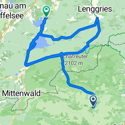
Other popular routes starting in Gnadenwald
 Gnadenwald Innsbruck und retour
- Distance
- 36.5 km
- Ascent
- 495 m
- Descent
- 495 m
- Location
- Gnadenwald, Tyrol, Austria
 Engalm - Lamsensattel - Fiecht
- Distance
- 20 km
- Ascent
- 805 m
- Descent
- 1,419 m
- Location
- Gnadenwald, Tyrol, Austria
 Main - Alpen 9. Teil: Eng-Alm - Grainau
- Distance
- 64.5 km
- Ascent
- 253 m
- Descent
- 710 m
- Location
- Gnadenwald, Tyrol, Austria
 Wallgau-Eng Alm
- Distance
- 37.4 km
- Ascent
- 172 m
- Descent
- 520 m
- Location
- Gnadenwald, Tyrol, Austria
 Engalm - Spitzingsee
- Distance
- 84.3 km
- Ascent
- 699 m
- Descent
- 814 m
- Location
- Gnadenwald, Tyrol, Austria
 rund wachensee and wally
- Distance
- 136.7 km
- Ascent
- 638 m
- Descent
- 1,216 m
- Location
- Gnadenwald, Tyrol, Austria
 Walderalm / Hinterhornalm
- Distance
- 23.8 km
- Ascent
- 713 m
- Descent
- 715 m
- Location
- Gnadenwald, Tyrol, Austria
 Hinterhorn / Walder Alm
- Distance
- 28.6 km
- Ascent
- 915 m
- Descent
- 1,081 m
- Location
- Gnadenwald, Tyrol, Austria
Open it in the app