

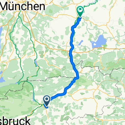
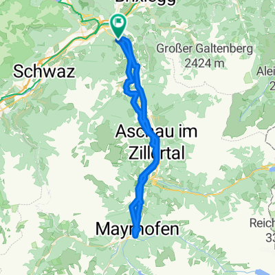
Strass-Kerschbaumersattel retour
A cycling route starting in Bruck am Ziller, Tyrol, Austria.
Overview
About this route
Start in front of the Strasser municipal office parking lot
- -:--
- Duration
- 20.9 km
- Distance
- 746 m
- Ascent
- 746 m
- Descent
- ---
- Avg. speed
- ---
- Max. altitude

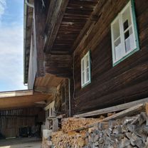
Route photos


Route quality
Waytypes & surfaces along the route
Waytypes
Quiet road
9.6 km
(46 %)
Track
4 km
(19 %)
Surfaces
Paved
11.1 km
(53 %)
Unpaved
4 km
(19 %)
Asphalt
11.1 km
(53 %)
Gravel
2.7 km
(13 %)
Continue with Bikemap
Use, edit, or download this cycling route
You would like to ride Strass-Kerschbaumersattel retour or customize it for your own trip? Here is what you can do with this Bikemap route:
Free features
- Save this route as favorite or in collections
- Copy & plan your own version of this route
- Sync your route with Garmin or Wahoo
Premium features
Free trial for 3 days, or one-time payment. More about Bikemap Premium.
- Navigate this route on iOS & Android
- Export a GPX / KML file of this route
- Create your custom printout (try it for free)
- Download this route for offline navigation
Discover more Premium features.
Get Bikemap PremiumFrom our community
Other popular routes starting in Bruck am Ziller
 Strass-Kerschbaumersattel retour
- Distance
- 20.9 km
- Ascent
- 746 m
- Descent
- 746 m
- Location
- Bruck am Ziller, Tyrol, Austria
 Schlitters 58G, Schlitters nach Planbergstraße 23, Eben am Achensee
- Distance
- 16.1 km
- Ascent
- 1,244 m
- Descent
- 839 m
- Location
- Bruck am Ziller, Tyrol, Austria
 Reither Kogel - Alpbachtal
- Distance
- 29.1 km
- Ascent
- 1,009 m
- Descent
- 1,009 m
- Location
- Bruck am Ziller, Tyrol, Austria
 Schlitterer See - Rattenberg
- Distance
- 8.4 km
- Ascent
- 57 m
- Descent
- 51 m
- Location
- Bruck am Ziller, Tyrol, Austria
 Bruckerberg-Bergrast
- Distance
- 38.4 km
- Ascent
- 1,210 m
- Descent
- 1,212 m
- Location
- Bruck am Ziller, Tyrol, Austria
 Imming, Bruck am Ziller nach Marienplatz, Wasserburg am Inn
- Distance
- 106.6 km
- Ascent
- 400 m
- Descent
- 519 m
- Location
- Bruck am Ziller, Tyrol, Austria
 gnadenwald hinterhorn
- Distance
- 81.7 km
- Ascent
- 1,144 m
- Descent
- 1,144 m
- Location
- Bruck am Ziller, Tyrol, Austria
 Zillertal
- Distance
- 60.8 km
- Ascent
- 377 m
- Descent
- 374 m
- Location
- Bruck am Ziller, Tyrol, Austria
Open it in the app