

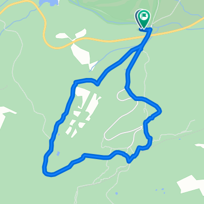
Abantos Grip - Rodrigo
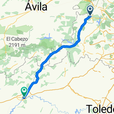
A cycling route starting in El Escorial, Madrid, Spain.
Overview
About this route
9:27 on Sunday, April 14, 2019
DH Piñas short DH Zetas Gallegos right variant Takeoff Zetas / Vascos final
- -:--
- Duration
- 28.3 km
- Distance
- 1,105 m
- Ascent
- 1,103 m
- Descent
- ---
- Avg. speed
- ---
- Max. altitude

Continue with Bikemap
Use, edit, or download this cycling route
You would like to ride Abantos Grip - Rodrigo or customize it for your own trip? Here is what you can do with this Bikemap route:
Free features
- Save this route as favorite or in collections
- Copy & plan your own version of this route
- Sync your route with Garmin or Wahoo
Premium features
Free trial for 3 days, or one-time payment. More about Bikemap Premium.
- Navigate this route on iOS & Android
- Export a GPX / KML file of this route
- Create your custom printout (try it for free)
- Download this route for offline navigation
Discover more Premium features.
Get Bikemap PremiumFrom our community
Other popular routes starting in El Escorial
 Silla de Felipe II
- Distance
- 20.4 km
- Ascent
- 330 m
- Descent
- 330 m
- Location
- El Escorial, Madrid, Spain
 Abantose-bike
- Distance
- 26.8 km
- Ascent
- 1,432 m
- Descent
- 1,432 m
- Location
- El Escorial, Madrid, Spain
 Subida a Abantos
- Distance
- 27.5 km
- Ascent
- 663 m
- Descent
- 662 m
- Location
- El Escorial, Madrid, Spain
 Abantos Grip - Rodrigo
- Distance
- 28.3 km
- Ascent
- 1,105 m
- Descent
- 1,103 m
- Location
- El Escorial, Madrid, Spain
 2000 - san lorenzo del escorial - talavera de la reina - 110 km - 1660 d
- Distance
- 110.3 km
- Ascent
- 869 m
- Descent
- 1,564 m
- Location
- El Escorial, Madrid, Spain
 ABANTOS
- Distance
- 9.6 km
- Ascent
- 662 m
- Descent
- 662 m
- Location
- El Escorial, Madrid, Spain
 Silla de Felipe II
- Distance
- 4.5 km
- Ascent
- 129 m
- Descent
- 131 m
- Location
- El Escorial, Madrid, Spain
 San Lorenzo del Escorial- Navacerrada
- Distance
- 54.9 km
- Ascent
- 594 m
- Descent
- 640 m
- Location
- El Escorial, Madrid, Spain
Open it in the app