Kochertalrunde 36 km
A cycling route starting in Öhringen, Baden-Württemberg, Germany.
Overview
About this route
- -:--
- Duration
- 41.9 km
- Distance
- 317 m
- Ascent
- 322 m
- Descent
- ---
- Avg. speed
- ---
- Avg. speed
Route quality
Waytypes & surfaces along the route
Waytypes
Road
11.6 km
(28 %)
Quiet road
10.9 km
(26 %)
Surfaces
Paved
35.1 km
(84 %)
Unpaved
1.6 km
(4 %)
Asphalt
32.6 km
(78 %)
Concrete
1.9 km
(5 %)
Continue with Bikemap
Use, edit, or download this cycling route
You would like to ride Kochertalrunde 36 km or customize it for your own trip? Here is what you can do with this Bikemap route:
Free features
- Save this route as favorite or in collections
- Copy & plan your own version of this route
- Sync your route with Garmin or Wahoo
Premium features
Free trial for 3 days, or one-time payment. More about Bikemap Premium.
- Navigate this route on iOS & Android
- Export a GPX / KML file of this route
- Create your custom printout (try it for free)
- Download this route for offline navigation
Discover more Premium features.
Get Bikemap PremiumFrom our community
Other popular routes starting in Öhringen
- Ohrntalrunde
- Distance
- 30.1 km
- Ascent
- 332 m
- Descent
- 332 m
- Location
- Öhringen, Baden-Württemberg, Germany
- Hohenloher Limes
- Distance
- 27 km
- Ascent
- 420 m
- Descent
- 420 m
- Location
- Öhringen, Baden-Württemberg, Germany
- Neuenstein Eschbach Michelbach Pfedelbach Öhringen
- Distance
- 22.2 km
- Ascent
- 266 m
- Descent
- 273 m
- Location
- Öhringen, Baden-Württemberg, Germany
- Öhringen Sindringen Ohrnberg
- Distance
- 31.1 km
- Ascent
- 275 m
- Descent
- 261 m
- Location
- Öhringen, Baden-Württemberg, Germany
- Kochertour
- Distance
- 83.2 km
- Ascent
- 328 m
- Descent
- 330 m
- Location
- Öhringen, Baden-Württemberg, Germany
- Pfedelbach-01
- Distance
- 41.9 km
- Ascent
- 585 m
- Descent
- 583 m
- Location
- Öhringen, Baden-Württemberg, Germany
- Im Möhriger Feld 2, Öhringen to Lindenallee 8, Öhringen
- Distance
- 6.3 km
- Ascent
- 92 m
- Descent
- 96 m
- Location
- Öhringen, Baden-Württemberg, Germany
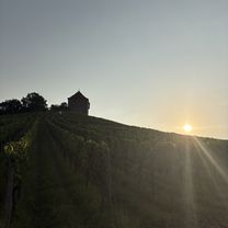
- Hohenloher Perlen Radweg (39 km)
- Distance
- 39 km
- Ascent
- 471 m
- Descent
- 471 m
- Location
- Öhringen, Baden-Württemberg, Germany
Open it in the app