SSWSC Rabbit Ears Time Trail Course
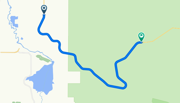
A cycling route starting in Steamboat Springs, Colorado, United States of America.
Overview
About this route
This is a time trial course that is part of the SSWSC training race series. THe course starts at the intersection if RCR 20 and Hwy 40 and finishes at the West Summit Parking Lot. Course record, set 5.20.10, is 33:19!
- -:--
- Duration
- 12.7 km
- Distance
- 778 m
- Ascent
- 68 m
- Descent
- ---
- Avg. speed
- ---
- Avg. speed
Route quality
Waytypes & surfaces along the route
Waytypes
Cycleway
12.2 km
(96 %)
Access road
0.5 km
(4 %)
Surfaces
Paved
12.2 km
(96 %)
Unpaved
0.5 km
(4 %)
Paved (undefined)
12.2 km
(96 %)
Unpaved (undefined)
0.5 km
(4 %)
Continue with Bikemap
Use, edit, or download this cycling route
You would like to ride SSWSC Rabbit Ears Time Trail Course or customize it for your own trip? Here is what you can do with this Bikemap route:
Free features
- Save this route as favorite or in collections
- Copy & plan your own version of this route
- Sync your route with Garmin or Wahoo
Premium features
Free trial for 3 days, or one-time payment. More about Bikemap Premium.
- Navigate this route on iOS & Android
- Export a GPX / KML file of this route
- Create your custom printout (try it for free)
- Download this route for offline navigation
Discover more Premium features.
Get Bikemap PremiumFrom our community
Other popular routes starting in Steamboat Springs
- Snail-like route in Steamboat Springs
- Distance
- 25.7 km
- Ascent
- 382 m
- Descent
- 383 m
- Location
- Steamboat Springs, Colorado, United States of America
- SSWSC Rabbit Ears Time Trail Course
- Distance
- 12.7 km
- Ascent
- 778 m
- Descent
- 68 m
- Location
- Steamboat Springs, Colorado, United States of America
- Collins Corner Loop
- Distance
- 21.9 km
- Ascent
- 259 m
- Descent
- 259 m
- Location
- Steamboat Springs, Colorado, United States of America
- 24 Hour 'Boat Cruise
- Distance
- 21 km
- Ascent
- 187 m
- Descent
- 189 m
- Location
- Steamboat Springs, Colorado, United States of America
- 33A to 44 Loop
- Distance
- 38.2 km
- Ascent
- 424 m
- Descent
- 424 m
- Location
- Steamboat Springs, Colorado, United States of America
- Stage 2: Steamboat Springs to Frisco
- Distance
- 188.6 km
- Ascent
- 1,505 m
- Descent
- 828 m
- Location
- Steamboat Springs, Colorado, United States of America
- 2011 USA Pro Cycling Challenge - Stage 5
- Distance
- 166.3 km
- Ascent
- 1,679 m
- Descent
- 827 m
- Location
- Steamboat Springs, Colorado, United States of America
- Sparta Plaza 1200, Steamboat Springs to Sparta Plaza 1200, Steamboat Springs
- Distance
- 27.9 km
- Ascent
- 327 m
- Descent
- 331 m
- Location
- Steamboat Springs, Colorado, United States of America
Open it in the app