

vom Rhein zur Mosel
A cycling route starting in Koblenz, Rhineland-Palatinate, Germany.
Overview
About this route
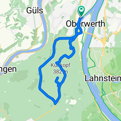
Heute die erste Inspektion meines Mountainbikes bei Canyon. Da ich es heute Abend wieder mitnehmen möchte, habe ich gestern eine Runde für das Trekkingbike geplant. Start also bei Canyon in Koblenz. Dann erst mal zum Deutschen Ecke und anschließend gemütlich den Rhein entlang bis Rhens. Von nun an geht es durch das Mühlental beständig nach oben bis Hünefeld und dem höchsten Punkt der Tour. Nun hinüber nach Waldems und nach einigem auf und ab bei Dieblich hinunter zur Mosel. Ein Stück Moselaufwärts bis zur Brücke nach Kobern-Gondorf hinüber. Nun gemächliches dahingleiten von einem Weindorf zum Nächsten. Wirklich schön hier. In Güls dann wieder auf die rechte Moselseite und zurück zum Ausgangspunkt. Das Mountainbike war dann übrigens auch schon fertig. #noebike
- -:--
- Duration
- 49.2 km
- Distance
- 383 m
- Ascent
- 386 m
- Descent
- ---
- Avg. speed
- ---
- Max. altitude

Route photos


Route quality
Waytypes & surfaces along the route
Waytypes
Quiet road
10.8 km
(22 %)
Track
9.2 km
(19 %)
Surfaces
Paved
39.4 km
(80 %)
Unpaved
5.5 km
(11 %)
Asphalt
26.9 km
(55 %)
Paving stones
8.1 km
(17 %)
Continue with Bikemap
Use, edit, or download this cycling route
You would like to ride vom Rhein zur Mosel or customize it for your own trip? Here is what you can do with this Bikemap route:
Free features
- Save this route as favorite or in collections
- Copy & plan your own version of this route
- Sync your route with Garmin or Wahoo
Premium features
Free trial for 3 days, or one-time payment. More about Bikemap Premium.
- Navigate this route on iOS & Android
- Export a GPX / KML file of this route
- Create your custom printout (try it for free)
- Download this route for offline navigation
Discover more Premium features.
Get Bikemap PremiumFrom our community
Other popular routes starting in Koblenz
 Ausflug Koblenz-Winningen und zurück, 22km
- Distance
- 21.5 km
- Ascent
- 88 m
- Descent
- 90 m
- Location
- Koblenz, Rhineland-Palatinate, Germany
 Koblenz - Bad Ems
- Distance
- 16.1 km
- Ascent
- 148 m
- Descent
- 139 m
- Location
- Koblenz, Rhineland-Palatinate, Germany
 Eisenarsch-Tour 2009 (Vorschlag)
- Distance
- 174.5 km
- Ascent
- 424 m
- Descent
- 353 m
- Location
- Koblenz, Rhineland-Palatinate, Germany
 Koblenz -Biedenkopf auf dem Lahnradweg
- Distance
- 223 km
- Ascent
- 573 m
- Descent
- 280 m
- Location
- Koblenz, Rhineland-Palatinate, Germany
 CYCLING THE RHINE: Route 12A
- Distance
- 49.7 km
- Ascent
- 179 m
- Descent
- 152 m
- Location
- Koblenz, Rhineland-Palatinate, Germany
 Winter
- Distance
- 15.5 km
- Ascent
- 360 m
- Descent
- 360 m
- Location
- Koblenz, Rhineland-Palatinate, Germany
 moseltour trier - koblenz
- Distance
- 205.6 km
- Ascent
- 554 m
- Descent
- 483 m
- Location
- Koblenz, Rhineland-Palatinate, Germany
 Mosel Thionville Mosel
- Distance
- 267 km
- Ascent
- 1,060 m
- Descent
- 989 m
- Location
- Koblenz, Rhineland-Palatinate, Germany
Open it in the app