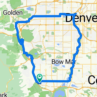
Trial Route 2
A cycling route starting in Ken Caryl, Colorado, United States of America.
Overview
About this route
C470 >> Mt Carbon >> Bear Creek Greenbelt >> Pierce St >> Marston Lake >> Clement Park >> Lilly Gulch
- -:--
- Duration
- 39.7 km
- Distance
- 238 m
- Ascent
- 238 m
- Descent
- ---
- Avg. speed
- ---
- Max. altitude
Route quality
Waytypes & surfaces along the route
Waytypes
Cycleway
18.2 km
(46 %)
Road
10.6 km
(27 %)
Surfaces
Paved
25.5 km
(64 %)
Unpaved
0.3 km
(<1 %)
Concrete
17 km
(43 %)
Asphalt
5.1 km
(13 %)
Continue with Bikemap
Use, edit, or download this cycling route
You would like to ride Trial Route 2 or customize it for your own trip? Here is what you can do with this Bikemap route:
Free features
- Save this route as favorite or in collections
- Copy & plan your own version of this route
- Sync your route with Garmin or Wahoo
Premium features
Free trial for 3 days, or one-time payment. More about Bikemap Premium.
- Navigate this route on iOS & Android
- Export a GPX / KML file of this route
- Create your custom printout (try it for free)
- Download this route for offline navigation
Discover more Premium features.
Get Bikemap PremiumFrom our community
Other popular routes starting in Ken Caryl
- PICU Peloton Deer Creek Canyon Short
- Distance
- 52.6 km
- Ascent
- 1,189 m
- Descent
- 1,186 m
- Location
- Ken Caryl, Colorado, United States of America
- W Deer Creek Canyon Rd, Littleton to W Deer Creek Canyon Rd, Littleton
- Distance
- 53.5 km
- Ascent
- 1,162 m
- Descent
- 1,160 m
- Location
- Ken Caryl, Colorado, United States of America
- Grizzly Drive 13896, Littleton to Grizzly Drive 13896, Littleton
- Distance
- 5.7 km
- Ascent
- 239 m
- Descent
- 225 m
- Location
- Ken Caryl, Colorado, United States of America
- 85 Mi loop High Grd Shdw Mt High Dr Witter Gulch
- Distance
- 137.2 km
- Ascent
- 2,089 m
- Descent
- 2,089 m
- Location
- Ken Caryl, Colorado, United States of America
- 50 Mi HiGrd ShdwMt Loop
- Distance
- 82.7 km
- Ascent
- 1,300 m
- Descent
- 1,303 m
- Location
- Ken Caryl, Colorado, United States of America
- Black Mountain
- Distance
- 83.7 km
- Ascent
- 2,350 m
- Descent
- 2,327 m
- Location
- Ken Caryl, Colorado, United States of America
- Ken Caryl/High Grade loop
- Distance
- 45.7 km
- Ascent
- 1,281 m
- Descent
- 1,254 m
- Location
- Ken Caryl, Colorado, United States of America
- Trial Route 2
- Distance
- 39.7 km
- Ascent
- 238 m
- Descent
- 238 m
- Location
- Ken Caryl, Colorado, United States of America
Open it in the app