

Trasa 3 (miniB) - Poranny śpiew ptasiej grobli (B)
A cycling route starting in Zator, Lesser Poland Voivodeship, Poland.
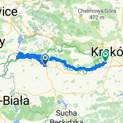
Overview
About this route
- -:--
- Duration
- 16.6 km
- Distance
- 35 m
- Ascent
- 36 m
- Descent
- ---
- Avg. speed
- ---
- Max. altitude

Route quality
Waytypes & surfaces along the route
Waytypes
Quiet road
6.4 km
(39 %)
Track
3.9 km
(24 %)
Surfaces
Paved
12 km
(72 %)
Unpaved
4 km
(24 %)
Asphalt
12 km
(72 %)
Ground
2.6 km
(15 %)
Continue with Bikemap
Use, edit, or download this cycling route
You would like to ride Trasa 3 (miniB) - Poranny śpiew ptasiej grobli (B) or customize it for your own trip? Here is what you can do with this Bikemap route:
Free features
- Save this route as favorite or in collections
- Copy & plan your own version of this route
- Sync your route with Garmin or Wahoo
Premium features
Free trial for 3 days, or one-time payment. More about Bikemap Premium.
- Navigate this route on iOS & Android
- Export a GPX / KML file of this route
- Create your custom printout (try it for free)
- Download this route for offline navigation
Discover more Premium features.
Get Bikemap PremiumFrom our community
Other popular routes starting in Zator
 Trasa 3 (miniA) - Poranny śpiew ptasiej grobli (B)
- Distance
- 17.1 km
- Ascent
- 23 m
- Descent
- 20 m
- Location
- Zator, Lesser Poland Voivodeship, Poland
 Trasa 3 (miniB) - Poranny śpiew ptasiej grobli (B)
- Distance
- 16.6 km
- Ascent
- 35 m
- Descent
- 36 m
- Location
- Zator, Lesser Poland Voivodeship, Poland
 Pętla_wokol_Zatora
- Distance
- 40.7 km
- Ascent
- 52 m
- Descent
- 52 m
- Location
- Zator, Lesser Poland Voivodeship, Poland
 Zatorska 83, Podolsze do Długa 50, Podolsze
- Distance
- 58.5 km
- Ascent
- 105 m
- Descent
- 103 m
- Location
- Zator, Lesser Poland Voivodeship, Poland
 Dolina Karpia - Pętla
- Distance
- 40.2 km
- Ascent
- 54 m
- Descent
- 52 m
- Location
- Zator, Lesser Poland Voivodeship, Poland
 Wiślana Trasa Rowerowa - Małopolska
- Distance
- 47.8 km
- Ascent
- 41 m
- Descent
- 34 m
- Location
- Zator, Lesser Poland Voivodeship, Poland
 Zator PKP_Oświęcim_Krk_Czerwone Maki
- Distance
- 87.5 km
- Ascent
- 139 m
- Descent
- 141 m
- Location
- Zator, Lesser Poland Voivodeship, Poland
 Zator i okolice
- Distance
- 47.6 km
- Ascent
- 500 m
- Descent
- 499 m
- Location
- Zator, Lesser Poland Voivodeship, Poland
Open it in the app