

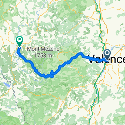
1996_13_valence_lepuyenvelay
A cycling route starting in Guilherand-Granges, Auvergne-Rhône-Alpes, France.
Overview
About this route
km 9 cote du pin 3
km 20 col des fans 3
km 45 col des nonieres 3
km 60 sprint intermedio
km 82 col de lachamp 2
km 110 cote du beage 4
km 124 sprint intermedio
- -:--
- Duration
- 145.1 km
- Distance
- 2,008 m
- Ascent
- 1,503 m
- Descent
- ---
- Avg. speed
- ---
- Max. altitude

Route quality
Waytypes & surfaces along the route
Waytypes
Road
23.2 km
(16 %)
Quiet road
13.1 km
(9 %)
Surfaces
Paved
79.8 km
(55 %)
Unpaved
1.5 km
(1 %)
Asphalt
79.8 km
(55 %)
Loose gravel
1.5 km
(1 %)
Undefined
63.8 km
(44 %)
Continue with Bikemap
Use, edit, or download this cycling route
You would like to ride 1996_13_valence_lepuyenvelay or customize it for your own trip? Here is what you can do with this Bikemap route:
Free features
- Save this route as favorite or in collections
- Copy & plan your own version of this route
- Split it into stages to create a multi-day tour
- Sync your route with Garmin or Wahoo
Premium features
Free trial for 3 days, or one-time payment. More about Bikemap Premium.
- Navigate this route on iOS & Android
- Export a GPX / KML file of this route
- Create your custom printout (try it for free)
- Download this route for offline navigation
Discover more Premium features.
Get Bikemap PremiumFrom our community
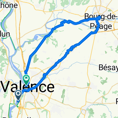
Other popular routes starting in Guilherand-Granges
 droga z Valence do Avignon
- Distance
- 146.3 km
- Ascent
- 449 m
- Descent
- 535 m
- Location
- Guilherand-Granges, Auvergne-Rhône-Alpes, France
 1996_13_valence_lepuyenvelay
- Distance
- 145.1 km
- Ascent
- 2,008 m
- Descent
- 1,503 m
- Location
- Guilherand-Granges, Auvergne-Rhône-Alpes, France
 romans sur Isère
- Distance
- 46.5 km
- Ascent
- 220 m
- Descent
- 208 m
- Location
- Guilherand-Granges, Auvergne-Rhône-Alpes, France
 2019 - 5a
- Distance
- 106.7 km
- Ascent
- 486 m
- Descent
- 376 m
- Location
- Guilherand-Granges, Auvergne-Rhône-Alpes, France
 Le Tour De France: Stage 9
- Distance
- 200.5 km
- Ascent
- 3,003 m
- Descent
- 2,360 m
- Location
- Guilherand-Granges, Auvergne-Rhône-Alpes, France
 Valence - St Romains de Lerps - 1000mD+ - 44km
- Distance
- 41 km
- Ascent
- 731 m
- Descent
- 733 m
- Location
- Guilherand-Granges, Auvergne-Rhône-Alpes, France
 19 giugno
- Distance
- 138.5 km
- Ascent
- 18 m
- Descent
- 105 m
- Location
- Guilherand-Granges, Auvergne-Rhône-Alpes, France
 Dia 3 - Valence a Viviers
- Distance
- 80.5 km
- Ascent
- 243 m
- Descent
- 277 m
- Location
- Guilherand-Granges, Auvergne-Rhône-Alpes, France
Open it in the app