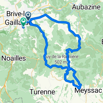
1996_16_brive_villeneuvesurlot
A cycling route starting in Brive-la-Gaillarde, Aquitaine-Limousin-Poitou-Charentes, France.
Overview
About this route
km 21 sprint intermedio
km 38 Cote de Jouhan Le Potre 4
km 48 Cote d'alvignac les eaux 4
km 68 cote de cales 4
km 158 sprint intermedio
- -:--
- Duration
- 178 km
- Distance
- 958 m
- Ascent
- 1,035 m
- Descent
- ---
- Avg. speed
- ---
- Avg. speed
Route quality
Waytypes & surfaces along the route
Waytypes
Busy road
113.4 km
(64 %)
Quiet road
41.6 km
(23 %)
Surfaces
Paved
64.9 km
(36 %)
Unpaved
1.3 km
(<1 %)
Asphalt
64.6 km
(36 %)
Unpaved (undefined)
0.9 km
(<1 %)
Continue with Bikemap
Use, edit, or download this cycling route
You would like to ride 1996_16_brive_villeneuvesurlot or customize it for your own trip? Here is what you can do with this Bikemap route:
Free features
- Save this route as favorite or in collections
- Copy & plan your own version of this route
- Sync your route with Garmin or Wahoo
Premium features
Free trial for 3 days, or one-time payment. More about Bikemap Premium.
- Navigate this route on iOS & Android
- Export a GPX / KML file of this route
- Create your custom printout (try it for free)
- Download this route for offline navigation
Discover more Premium features.
Get Bikemap PremiumFrom our community
Other popular routes starting in Brive-la-Gaillarde
- Brive -Luzech
- Distance
- 189 km
- Ascent
- 986 m
- Descent
- 979 m
- Location
- Brive-la-Gaillarde, Aquitaine-Limousin-Poitou-Charentes, France
- MA16 Brive-la-Gaillarde Hostel - Ussel Le Grand Hôtel
- Distance
- 90.2 km
- Ascent
- 1,228 m
- Descent
- 713 m
- Location
- Brive-la-Gaillarde, Aquitaine-Limousin-Poitou-Charentes, France
- Balade été 2018
- Distance
- 421.2 km
- Ascent
- 790 m
- Descent
- 897 m
- Location
- Brive-la-Gaillarde, Aquitaine-Limousin-Poitou-Charentes, France
- 1996_16_brive_villeneuvesurlot
- Distance
- 178 km
- Ascent
- 958 m
- Descent
- 1,035 m
- Location
- Brive-la-Gaillarde, Aquitaine-Limousin-Poitou-Charentes, France
- Juillet 2021 Volcans d'auvergne et Ardèche
- Distance
- 672.6 km
- Ascent
- 4,446 m
- Descent
- 4,514 m
- Location
- Brive-la-Gaillarde, Aquitaine-Limousin-Poitou-Charentes, France
- Brive-la-Gaillarde - Agen, 11. étape TdF 1951
- Distance
- 169.8 km
- Ascent
- 903 m
- Descent
- 971 m
- Location
- Brive-la-Gaillarde, Aquitaine-Limousin-Poitou-Charentes, France
- Event Brive bike a lot
- Distance
- 145.4 km
- Ascent
- 1,484 m
- Descent
- 1,455 m
- Location
- Brive-la-Gaillarde, Aquitaine-Limousin-Poitou-Charentes, France
- 19. Brive la Gaillard -Le puy de Sancy
- Distance
- 217.2 km
- Ascent
- 3,434 m
- Descent
- 1,714 m
- Location
- Brive-la-Gaillarde, Aquitaine-Limousin-Poitou-Charentes, France
Open it in the app