
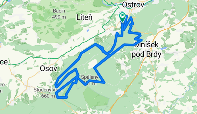
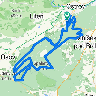
Trans Brdy trasa A final
A cycling route starting in Řevnice, Central Bohemia, Czechia.
Overview
About this route
- -:--
- Duration
- 90.3 km
- Distance
- 1,349 m
- Ascent
- 1,343 m
- Descent
- ---
- Avg. speed
- ---
- Max. altitude
Route quality
Waytypes & surfaces along the route
Waytypes
Track
72.2 km
(80 %)
Path
9.9 km
(11 %)
Surfaces
Paved
25.3 km
(28 %)
Unpaved
57.8 km
(64 %)
Gravel
35.2 km
(39 %)
Asphalt
16.2 km
(18 %)
Continue with Bikemap
Use, edit, or download this cycling route
You would like to ride Trans Brdy trasa A final or customize it for your own trip? Here is what you can do with this Bikemap route:
Free features
- Save this route as favorite or in collections
- Copy & plan your own version of this route
- Split it into stages to create a multi-day tour
- Sync your route with Garmin or Wahoo
Premium features
Free trial for 3 days, or one-time payment. More about Bikemap Premium.
- Navigate this route on iOS & Android
- Export a GPX / KML file of this route
- Create your custom printout (try it for free)
- Download this route for offline navigation
Discover more Premium features.
Get Bikemap PremiumFrom our community
Other popular routes starting in Řevnice
 Lety #1
- Distance
- 65.6 km
- Ascent
- 609 m
- Descent
- 609 m
- Location
- Řevnice, Central Bohemia, Czechia
 Brdská třicítka
- Distance
- 29.4 km
- Ascent
- 547 m
- Descent
- 547 m
- Location
- Řevnice, Central Bohemia, Czechia
 Český Kras 02
- Distance
- 23.7 km
- Ascent
- 286 m
- Descent
- 285 m
- Location
- Řevnice, Central Bohemia, Czechia
 Třebáň, sv.Jan, Amerika a zpět
- Distance
- 39.8 km
- Ascent
- 680 m
- Descent
- 689 m
- Location
- Řevnice, Central Bohemia, Czechia
 Klondajk - podél Berounky
- Distance
- 58.9 km
- Ascent
- 590 m
- Descent
- 529 m
- Location
- Řevnice, Central Bohemia, Czechia
 Trans Brdy trasa A final
- Distance
- 90.3 km
- Ascent
- 1,349 m
- Descent
- 1,343 m
- Location
- Řevnice, Central Bohemia, Czechia
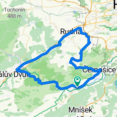
 Trails around Řevnice (CZ) #1
- Distance
- 44.5 km
- Ascent
- 930 m
- Descent
- 933 m
- Location
- Řevnice, Central Bohemia, Czechia
 CT D6 Karlstejn Praag
- Distance
- 37.1 km
- Ascent
- 300 m
- Descent
- 317 m
- Location
- Řevnice, Central Bohemia, Czechia
Open it in the app